News
Hurricane Iona Strengthens to Category 3, Remains South of Hawaii
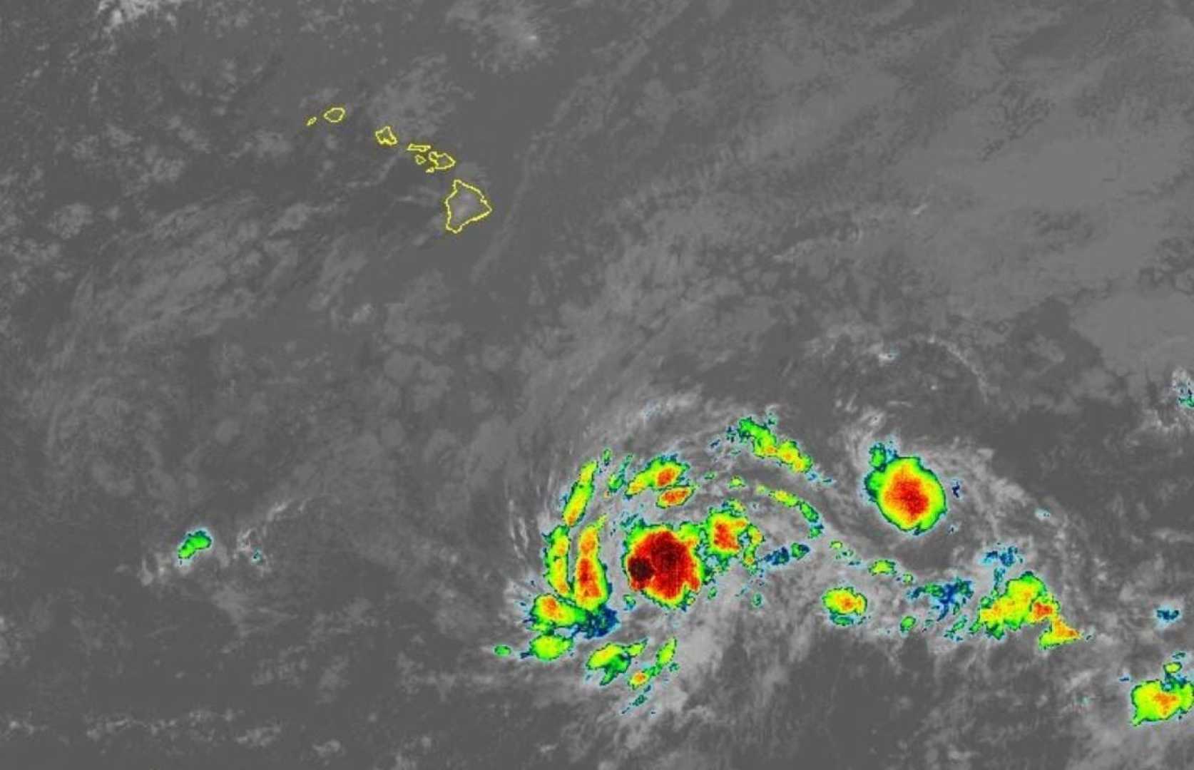
HONOLULU, Hawaii — Hurricane Iona has rapidly intensified into a Category 3 storm as it moves well south of the Hawaiian Islands. As of 5 a.m. Tuesday, Iona was located approximately 765 miles south-southeast of Honolulu, with maximum sustained winds of 125 mph and moving west at 13 mph, according to the Central Pacific Hurricane Center.
Forecasters anticipate Iona could reach Category 4 intensity later today. The storm’s hurricane-force winds extend outward up to 25 miles from its center, while tropical-storm-force winds spread out to 80 miles. Some additional strengthening is possible before a steady weakening phase is expected to begin on Wednesday, resulting from less favorable conditions.
Iona is forecasted to turn slightly to the west-northwest later this week; however, it will remain well south of the Hawaiian Islands. “Confidence remains high that Iona will stay well south of the Hawaiian Islands,” forecasters reported.
Meanwhile, Tropical Storm Keli is tracking west at about 13 mph and is located about 895 miles southeast of Honolulu with maximum sustained winds of 40 mph. Keli is expected to maintain its strength over the next 48 hours. Forecasters are also monitoring Keli closely, but as of now, it does not pose a threat to Hawaii.
The National Weather Service indicated that due to a high-pressure system building north of the state, trade winds will strengthen over the next couple of days. Clouds and showers are expected to favor windward areas, particularly overnight and in the early morning.
Neither Iona nor Keli are currently threatening Hawaii, and no coastal watches or warnings are in effect. Residents are encouraged to stay informed as the situation develops.


