News
Hurricane Kiko Approaches Hawaii, Threatening Heavy Rain and High Winds
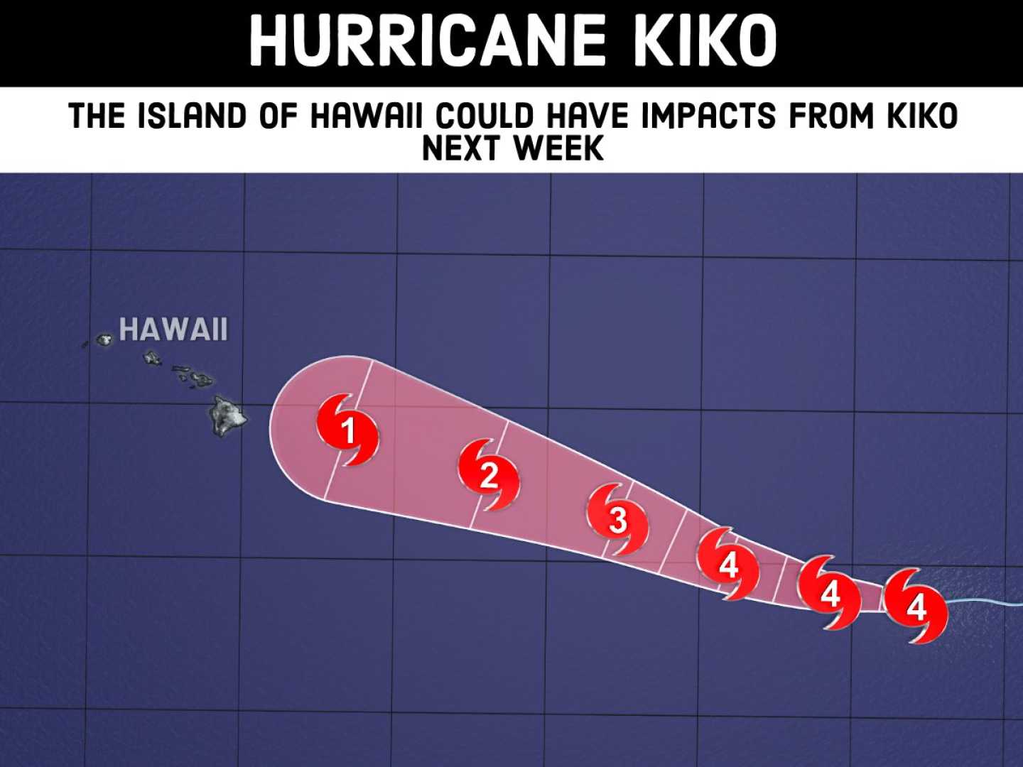
HONOLULU, Hawaii — Hurricane Kiko has weakened to a Category 3 storm with maximum sustained winds of 125 mph as it moves toward Hawaii, according to the National Hurricane Center. The hurricane is currently located about 1,360 miles east-southeast of Hilo and is forecast to approach the Hawaiian Islands early next week.
The storm’s intensity may fluctuate as it heads west at 9 mph, encountering cooler sea surface temperatures and increased wind shear. Despite this, the risk of direct rain and wind impacts is rising, though it remains uncertain how severe these effects will be.
In addition to strong winds, Kiko could produce heavy rainfall starting Monday, with associated flooding risks persisting into early Thursday. Forecasts indicate potential rainfall amounts of 1 to 2 inches per hour, especially across higher terrain.
As Kiko approaches, high surf and dangerous rip currents are anticipated, particularly on east-facing shores. Residents are urged to prepare their emergency supplies as the storm moves closer.
Hurricane Kiko had maximum winds of 130 mph earlier this week, but as of 5 p.m. Thursday, data indicated a slight weakening. Yet, experts suggest Kiko might re-intensify slightly before encountering conditions that could cause it to weaken rapidly.
The National Weather Service warns that even if Kiko remains a weaker storm, it could still bring significant wind and rain to the islands, impacting travel and daily life. With uncertainty still surrounding the storm’s track and intensity, residents are encouraged to stay updated as Kiko moves closer.
Weather officials are closely monitoring the system and will provide updates as needed. The Hawaii Emergency Management Agency advises inhabitants to have a plan in place should evacuation become necessary.


