News
Orlando Faces Cold Front As Halloween Approaches
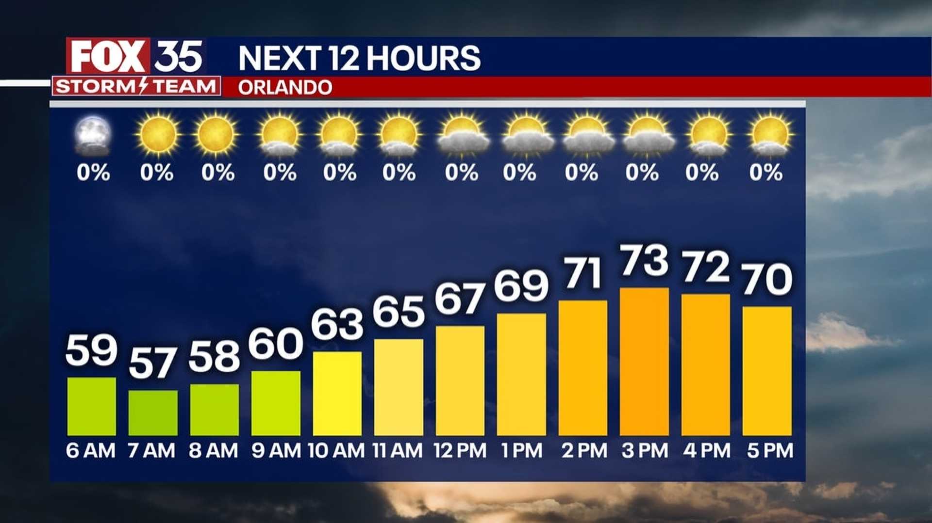
ORLANDO, Fla. – A cold front moved through Central Florida overnight, bringing cooler temperatures and strong winds. Meteorologists expect highs today only reaching the low 70s.
Orlando‘s temperature will peak at 73 degrees, which is 9 degrees lower than the average high of 82 degrees. The city will experience mostly sunny skies, but winds are expected to gust between 25 and 30 mph.
Tonight, temperatures will drop significantly, with lows expected between the upper 40s and low 50s. Orlando’s overnight low will be around 55 degrees.
Looking ahead to Halloween, the forecast indicates mostly sunny skies with a high of 71 degrees. Parents should prepare their trick-or-treaters to dress warmly as temperatures will cool into the 60s after sunset, and possibly dip into the 50s by 9 p.m.
As the weekend approaches, expect slightly warmer temperatures and sunshine, with highs hitting the mid to upper 70s. However, overnight lows will still remain cool, ranging from the upper 40s to low 50s.
Starting Sunday night, rain is forecasted to return as a warm front moves into the area. Residents may face heavy rainfall, with some neighborhoods potentially experiencing between 1 to 3 inches, especially in Brevard County.
Breezy conditions will persist along the coastline, prompting a high-surf advisory. Beachgoers should remain cautious due to the risk of rip currents and minor beach erosion.
The upcoming week will see a strong cold front arriving by Wednesday, setting the stage for much cooler temperatures heading into November. Daytime highs will drop to the low 70s by Friday, aligning with the chillier Halloween forecast.


