News
Severe Storm Risk for Eastern Indiana This Weekend
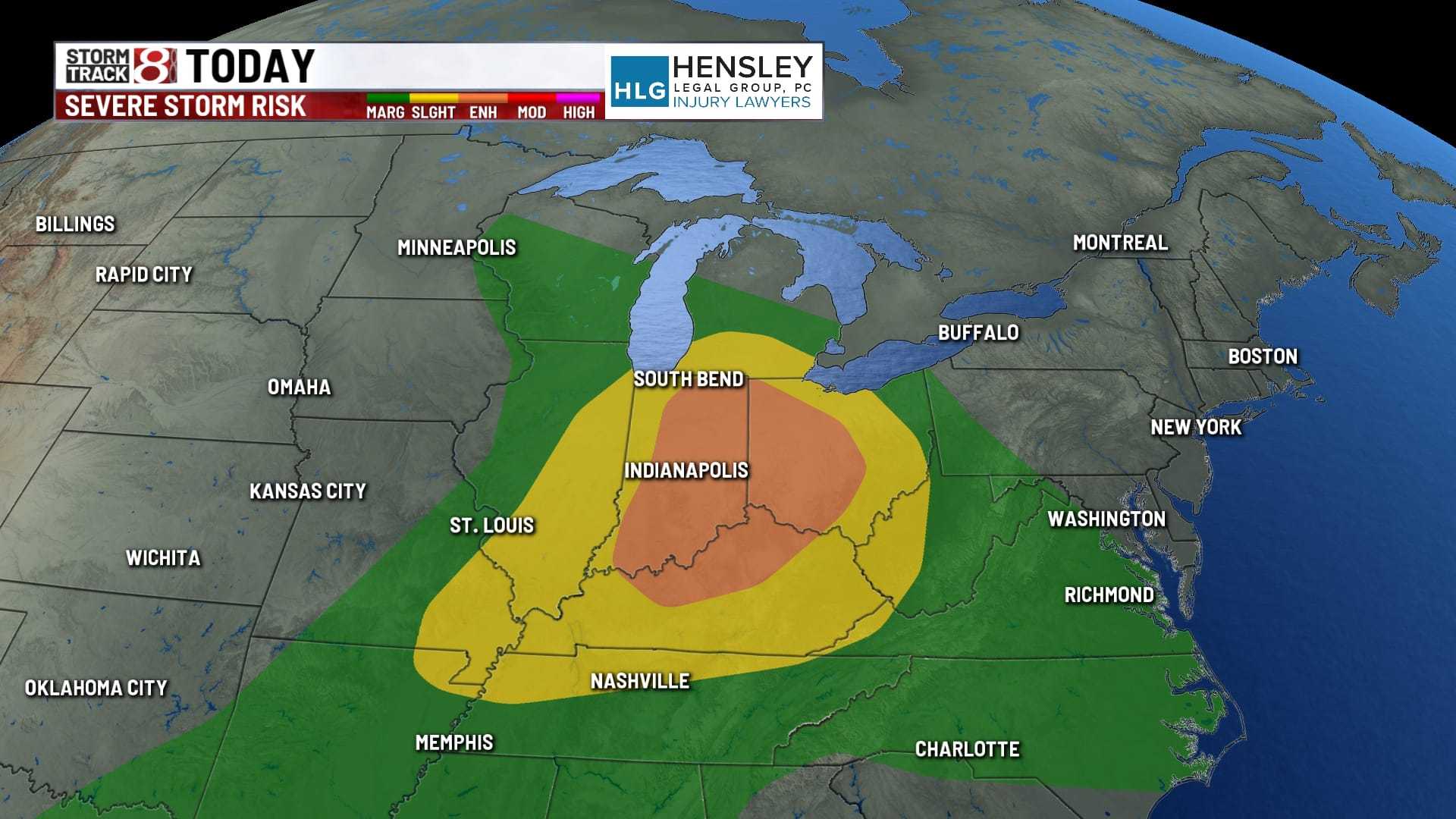
INDIANAPOLIS, Ind. — The Storm Prediction Center has issued a level 2 of 5 risk for scattered strong to severe storms across southern and eastern Indiana starting after 3 p.m. today. As residents prepare for the weekend, the weather is expected to bring both heat and potential storm activity.
Temperatures will rise into the low 90s this afternoon, with heat indices reaching between 100 to 105 degrees. Most of the state will experience dry hours before storms begin to form, particularly on the western side, as a cold front approaches.
Starting around 3 p.m., thunderstorms may develop, with a few isolated storms expected in northern Indiana. The storm coverage is anticipated to expand and move toward the Indianapolis metro area between 5 p.m. and 6 p.m.
The primary threat from these storms includes damaging wind gusts and brief heavy rainfall, which could lead to localized flooding in certain areas. Meteorologists indicate these storms may lose intensity as the sun sets, tapering off after 9 p.m. in eastern areas.
Overnight conditions are expected to remain partly cloudy with warm lows in the low 70s. Humidity will persist until the cold front fully passes through the region. On Sunday, the boundary is projected to stall across southern Indiana, leading to the possibility of a few additional scattered storms, mainly south of central Indiana, particularly during the afternoon.
Temperatures on Sunday are forecasted to peak in the mid to upper 80s, with slightly less muggy conditions as dew points drop to the mid-60s. Monday will offer a brief respite with milder temperatures near the upper 80s and lower dew points.
Residents are reminded to stay updated on weather conditions as daily storm chances emerge throughout the week, especially Thursday evening into Friday.


