News
Severe Storms Cause Flooding Across Phoenix Area
PHOENIX, Arizona — The East Valley faced severe weather on Monday as storms rolled through the area, causing flash flooding and power outages. The National Weather Service (NWS) issued a severe storm warning for parts of Phoenix, Mesa, Chandler, and surrounding communities in the afternoon.
Storms moved in from the south, bringing heavy rain, gusty winds, and the possibility of hail. A Flood Watch remains in effect for south-central Arizona, with concerns about flash flooding persisting into the evening. Meteorologists warned that some locations could receive over an inch of rain, with wind gusts exceeding 50 mph.
In the past three days, areas in the Valley received significant rainfall, with some locations reporting over two inches. Certain spots in the East Valley saw more than four inches, creating hazardous conditions.
“Tomorrow should be dry,” said NWS meteorologist Katherine Berislavich, “but we are watching for more isolated storms late into the evening.” By 3:15 p.m., the most severe part of the storm had moved out of the Valley, although additional cells were forming.
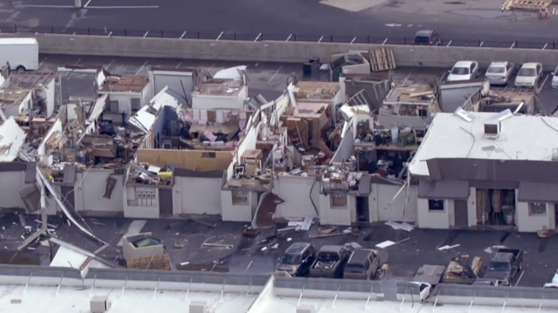
In Tempe, a microburst created winds of 70 mph, causing damage to several structures. Local authorities and the Maricopa County Flood Control District advised residents to avoid driving through standing water.
Power outages were reported across metro Phoenix, with multiple downed trees blocking roads. Chandler police noted specific closures due to fallen trees. The NWS confirmed rainfall totals included 0.23 inches at Sky Harbor International Airport, while Tempe recorded as much as 0.75 inches.
On Saturday, the Phoenix area set a daily rainfall record for October, receiving 1.96 inches. As the weather systems begin to clear, Monday night is expected to bring calmer conditions.


