News
Severe Storms Strike Northern Plains Causing Widespread Damage
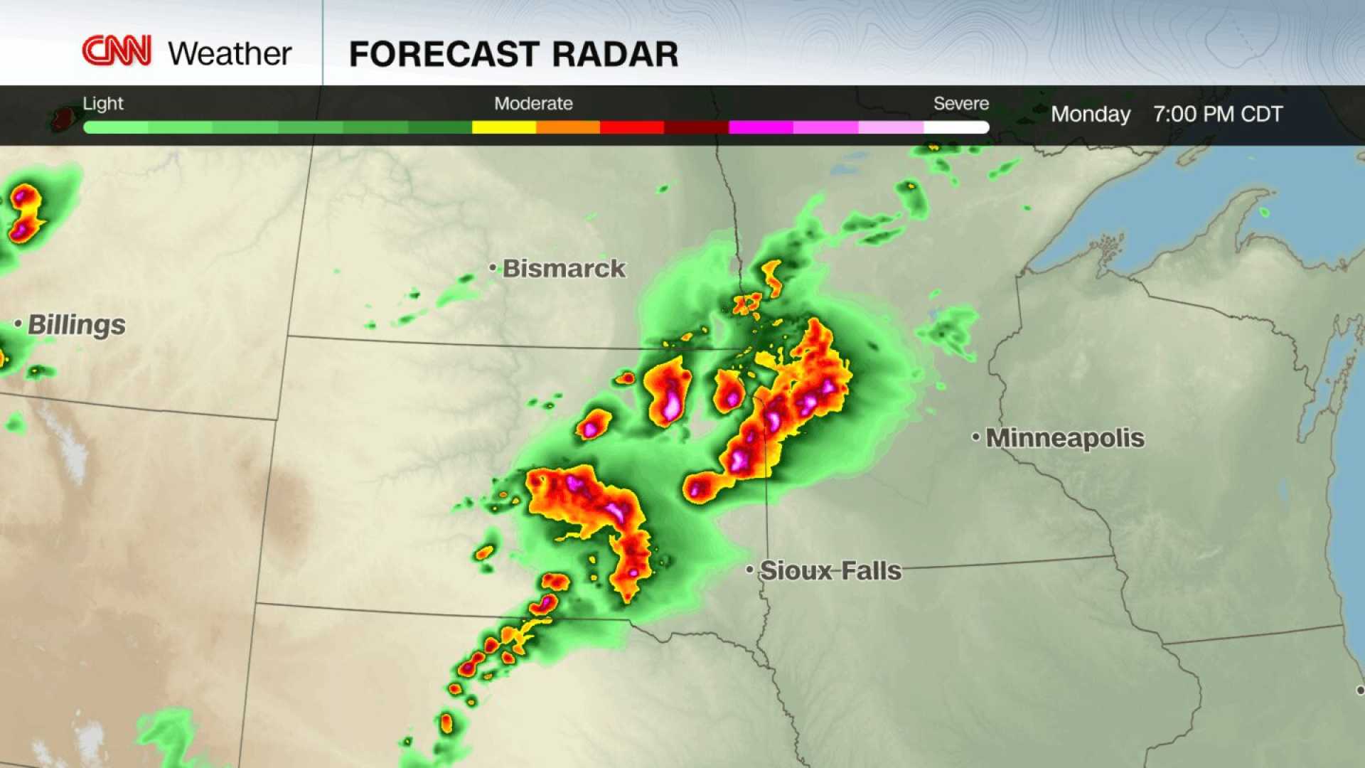
ABERDEEN, S.D. — Violent thunderstorms rolled across the northern Plains and upper Midwest overnight, causing significant damage and knocking out power to over 150,000 homes and businesses across Minnesota, Iowa, and Wisconsin. The storms, which featured hurricane-force wind gusts, began on July 28, 2025, and drew warnings from forecasters who feared the development of a rare derecho.
While the storm complex did not meet the distance criteria to officially be classified as a derecho, it still produced wind gusts exceeding 90 mph. The National Weather Service reported peak gusts of 99 mph near Sioux Center, Iowa, and 92 mph near Orange City and Spencer, Iowa. Trees were downed, and several large vehicles were overturned due to the intense winds.
The aftermath of the storms included damage to homes and businesses, as well as several tornadoes and large hail in parts of rural South Dakota and Iowa. Reports indicated that three tornadoes touched down in rural areas on the night of July 27. Golf ball-sized hail, along with flash flooding, was noted across the Minneapolis-St. Paul area.
As the storms advanced on July 29, the severe weather threat lessened to a Level 2 of 5 risk, with meteorologists specifying that the storms were expected to shift south and east into the central Plains and Great Lakes regions. The Weather Prediction Center has also identified a Level 2 risk of flooding rain, particularly in low-lying urban areas, due to saturated soils from preceding rainfall.
Forecasts indicated that intense thunderstorms would develop over western regions in the afternoon, with storms expected to move east into the evening. The storms were prompted by a storm system moving south and eastward. In total, over one million people in eastern South Dakota, southwestern Minnesota, and northern Iowa remained under a Level 4 out of 5 severe weather warning.
Experts emphasized the danger posed by straight-line wind gusts, noting that they can be as damaging as tornadoes. “The destructive winds today could very well do damage just like tornadoes do,” warned meteorologist Morgan. “If we end up getting a derecho, it could result in a much wider path of damage than typical storms.” This serious situation follows a day of severe weather that had already impacted South Dakota.


