News
Severe Thunderstorms and Heat Advisory in D.C. Region Tuesday
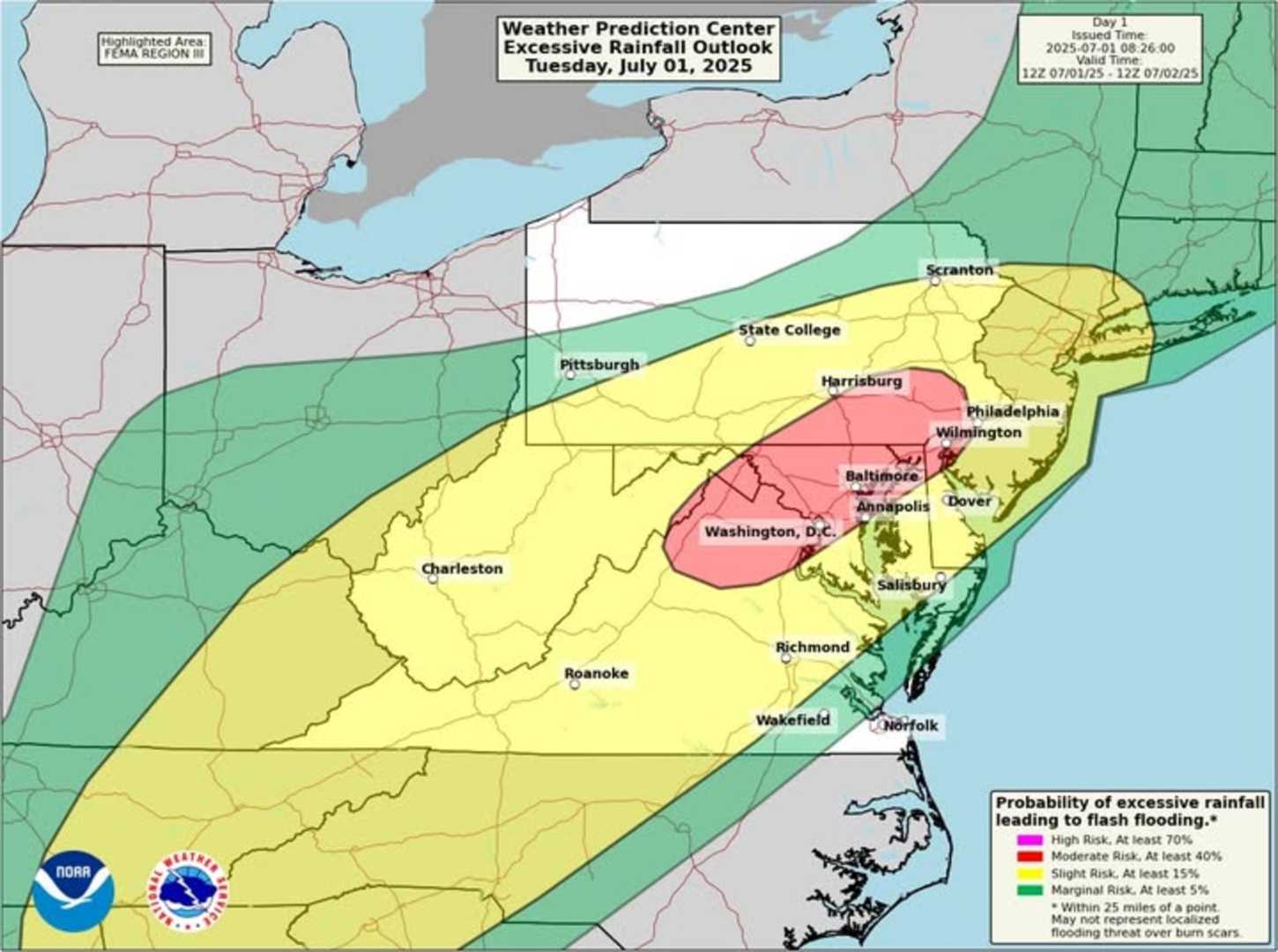
WASHINGTON, D.C. — A heat advisory and severe thunderstorm watch are in effect for the Washington, D.C., area on Tuesday as temperatures soar and storms approach. The National Weather Service (NWS) warns that the heat index could reach a dangerous 106 degrees due to high humidity.
The heat advisory started at 1 p.m. and will remain in effect until late Tuesday evening. Temperatures are forecast to reach around 95 degrees. In Maryland, counties such as Anne Arundel, Prince George’s, and Cecil are affected, while in Virginia, areas including Fairfax and Arlington are also under the advisory.
Afternoon thunderstorms are expected, with isolated severe storms bringing risks of damaging winds and flash flooding. Rainfall rates may reach two inches per hour, and wind gusts can exceed 60 mph. A flood watch is in effect for the District and surrounding areas, alerting residents to the potential for localized flooding.
The NWS advises residents to stay hydrated and limit outdoor activities to avoid heat-related illnesses. Those working outside should take regular breaks in shaded or air-conditioned areas.
As the storms develop, they will likely move eastward into the D.C. area by late afternoon. By early evening, showers may continue, giving way to lingering muggy conditions overnight with lows in the 70s. Even after the storms pass, a significant humidity level will persist into Wednesday, making it feel warmer.
Residents are encouraged to remain alert and tuned into weather updates as unstable conditions persist across the region. Any leftover storms will diminish, leaving behind a humid night, but the potential for further storms remains through the coming week.


