News
Severe Weather Alert for Middle Tennessee This Friday Evening
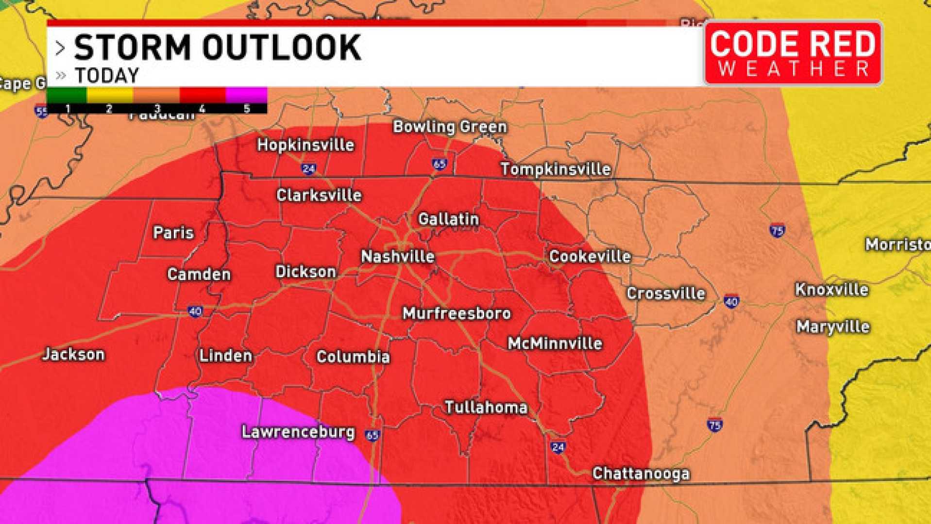
NASHVILLE, Tenn. (WSMV) – A First Alert Weather Day has been issued for late Friday afternoon and into the evening as strong thunderstorms are expected to impact Middle Tennessee.
The storms are forecasted to bring damaging wind gusts and possibly hail, with some stones reaching dime to quarter size. The window for severe weather is anticipated from 3 PM to 9 PM.
The approaching cold front will contribute to the unstable conditions necessary for these storms. According to meteorologists, the Storm Prediction Center has categorized Eastern Kentucky as having a Marginal Risk for severe weather, indicating potential hazards such as damaging winds, hail, and lightning.
As the evening unfolds, the weather may impact local events, including nighttime football games in the area.
Even though the severe weather is expected to pass by late Friday night, weather conditions will remain breezy, with gusts reaching about 25 mph.
The forecast for Saturday includes highs in the upper 60s and lows in the upper 40s, offering a calm and dry day after the storms. Following this weather disturbance, pleasant temperatures in the mid-70s are expected throughout next week.
Meteorologist Daniel Sawicki advises residents to stay alert for updates and to use the WSMV 4 First Alert Weather app for the latest information on the situation.


