News
Winter Storm Watch Issued for Upstate New York Ahead of Thanksgiving
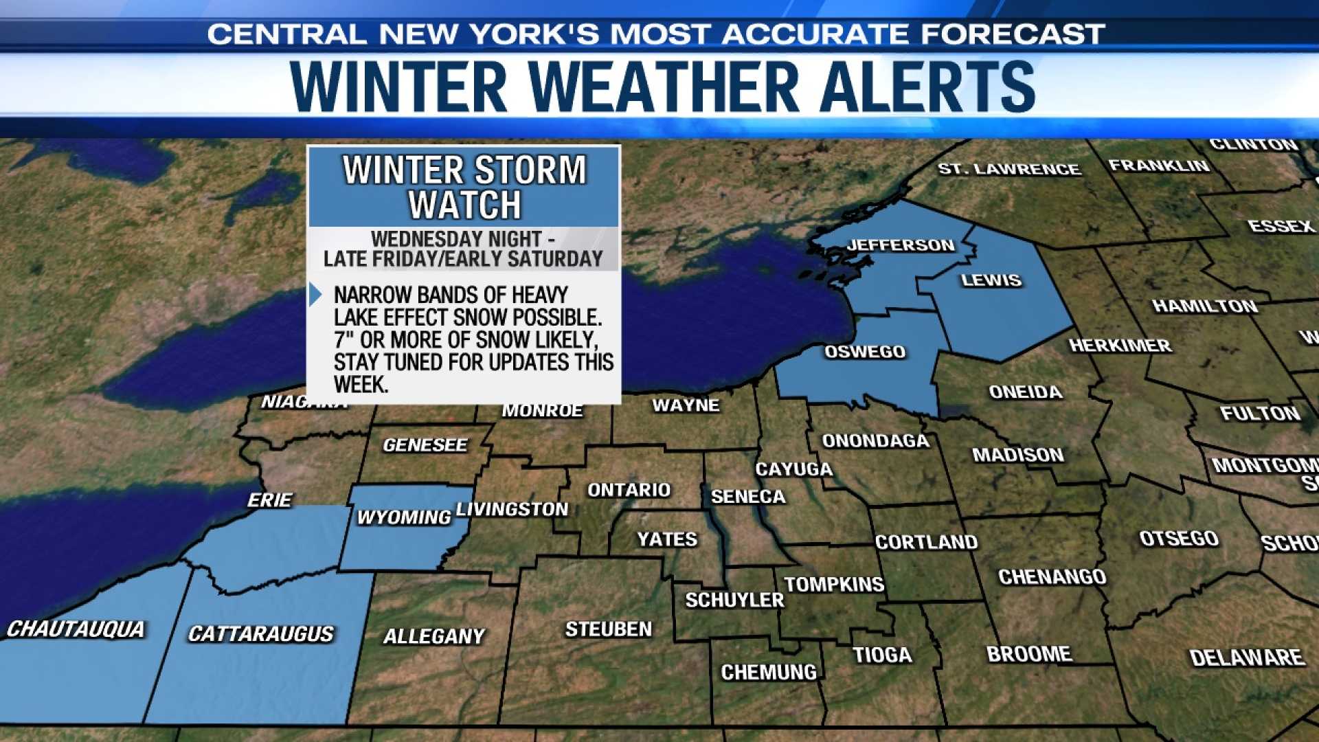
SYRACUSE, N.Y. — A Winter Storm Watch is now in effect for several counties in Upstate New York, as heavy lake effect snow and strong winds are expected to impact holiday travel. The watch covers Onondaga, Madison, Oneida, Herkimer, Oswego, Lewis, and Jefferson counties from Thursday through Saturday morning.
Road conditions are anticipated to be wet leading up to the storm, but Friday is predicted to be the worst day for travel in Central New York. Forecasters expect windy, cold conditions with highs in the lower 30s and snow-covered roads due to heavy lake effect snow.
Tuesday’s forecast in Central New York starts with mild weather, reaching a high of 51 degrees before a cold front arrives, bringing widespread rain between 1 and 3 p.m. Later in the week, temperatures are expected to drop significantly. Wednesday’s high could reach 60 degrees, but will plummet thereafter.
As the weather front moves in, cold winds from the west are likely to create hazardous driving conditions as they travel across the Great Lakes. The National Weather Service warns that low visibility and slippery roads could make travel treacherous during the busy Thanksgiving period.
The storm could deposit up to 7 inches of snow in some areas by Saturday morning, with wind gusts reaching 40 mph potentially causing whiteout conditions. This may particularly impact counties at the eastern ends of Lake Erie and Lake Ontario.
While Central New York may initially see limited snow, forecasters are monitoring changes closely as lake effect snow is notoriously unpredictable, often leading to localized heavy snowfall. Syracuse is expected to receive 3 to 8 inches from late Thursday through Saturday.
For travelers, the weather service advises planning for slippery road conditions and delays during the Thanksgiving holiday.


