News
Tornado Warning Expires as Chantal Moves Through North Carolina
RALEIGH, N.C. — A tornado warning for Alamance County has expired as Tropical Depression Chantal continues its path through central North Carolina. Doppler Radar indicated strong low-level rotation in a storm over Chatham County just after 4 p.m. Sunday. This storm, which was capable of producing a tornado, was moving west toward southern Alamance County.
The warning was lifted before the storm reached the county line, and as of 4:20 p.m. Sunday, there were no reports of wind damage in the area. Despite the warning’s expiration, isolated strong to severe storms remain a possibility across the eastern Triad.
“Chantal is slowing moving north with an inherent rotation that could trigger brief tornadoes,” said meteorologist Dylan Butler. He noted that the storm was expected to produce heavy rain and could lead to flash flooding in parts of the Triad, particularly in areas stretching from Greensboro to the Raleigh-Durham vicinity.
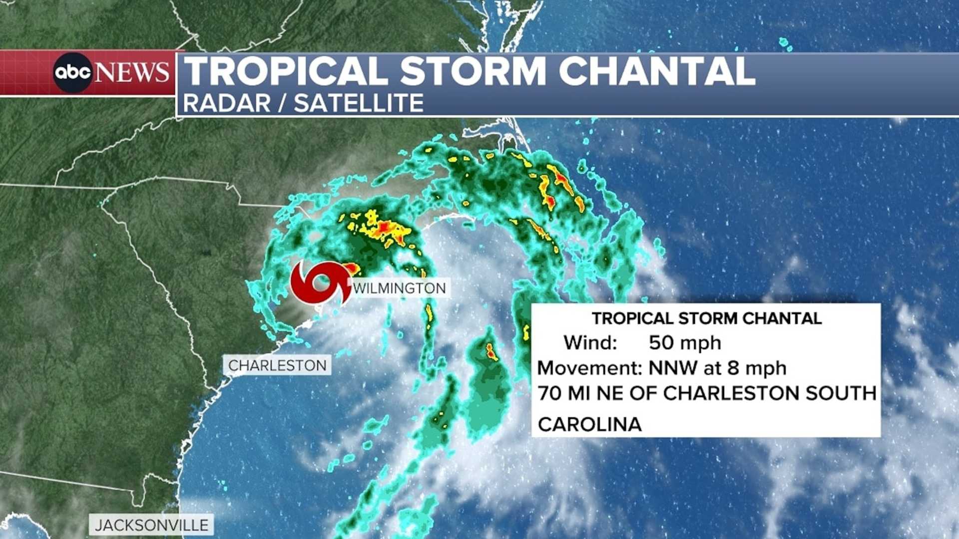
Chantal made landfall near Myrtle Beach earlier in the day, packing 50-mile-per-hour winds. Tidal areas were placed under tropical storm warnings, particularly in Horry County and Brunswick County, where bands of tropical rain and wind gusts were reported.
The storm is expected to weaken as it moves further inland, but residents are advised to be cautious. “The greatest concern today will be for isolated flash flooding, especially as heavy rainfall could accumulate quickly in some places,” Butler added.
Conditions are expected to improve overnight, with drier weather forecasted for Monday morning. Highs earlier in the week may climb back to the low 90s with a return to standard summer weather patterns.
Residents in the impacted areas are encouraged to stay updated on storm developments and heed any warnings from local officials.


