News
Hurricane Erin Heads Toward North Carolina Coast, Warnings Issued
WASHINGTON – A warmer Wednesday is expected across the Washington, D.C. region, bringing afternoon sunshine. However, coastal areas of Maryland, Virginia, and Delaware are bracing for potential effects from Hurricane Erin by Thursday.
Morning fog and light drizzle reduced visibility during the commute, but partial sunshine is expected by the afternoon, raising temperatures into the mid-80s. FOX 5 meteorologist Taylor Grenda reports that clouds will return by evening, leading to increased chances of showers overnight.
While Hurricane Erin is not forecast to make landfall, it will pass close enough to generate strong surf, rip currents, and wind gusts of 40 to 50 mph along beaches from Ocean City, Md., to Rehoboth Beach, Del. In the D.C. region, cooler temperatures and the threat of showers are anticipated.
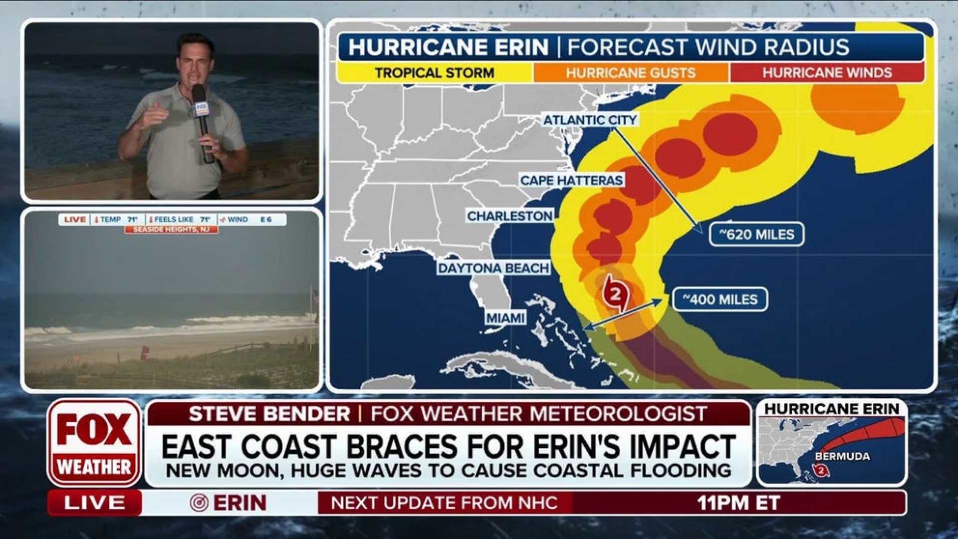
Erin, a Category 2 hurricane, is currently about 615 miles south-southeast of Cape Hatteras, N.C., with maximum sustained winds of 105 mph. Although the storm’s intensity has decreased from its previous winds of 140 mph, it is still expected to gain strength.
North Carolina’s Outer Banks are under a state of emergency, with mandatory evacuation orders for the Hatteras and Ocracoke islands. Residents are urged to leave before seawater overtakes Highway 12, which connects these areas.
Gov. Josh Stein declared the emergency to expedite resources for the coastal region. Meanwhile, hazardous swimming conditions have prompted no-swim advisories across popular beaches in Maryland, Virginia, Delaware, and NYC.
As Hurricane Erin continues its path, beach safety experts caution that the storm’s massive reach can create life-threatening rip currents, which can occur even if the center of the storm remains offshore.
Dare County Emergency Management Director Drew Pearson warned locals of the dangers: “Please, do not take the risk. Evacuate now, while it is still safe to do so.”


