News
Heat and Humidity Persist with Storms Expected This Week
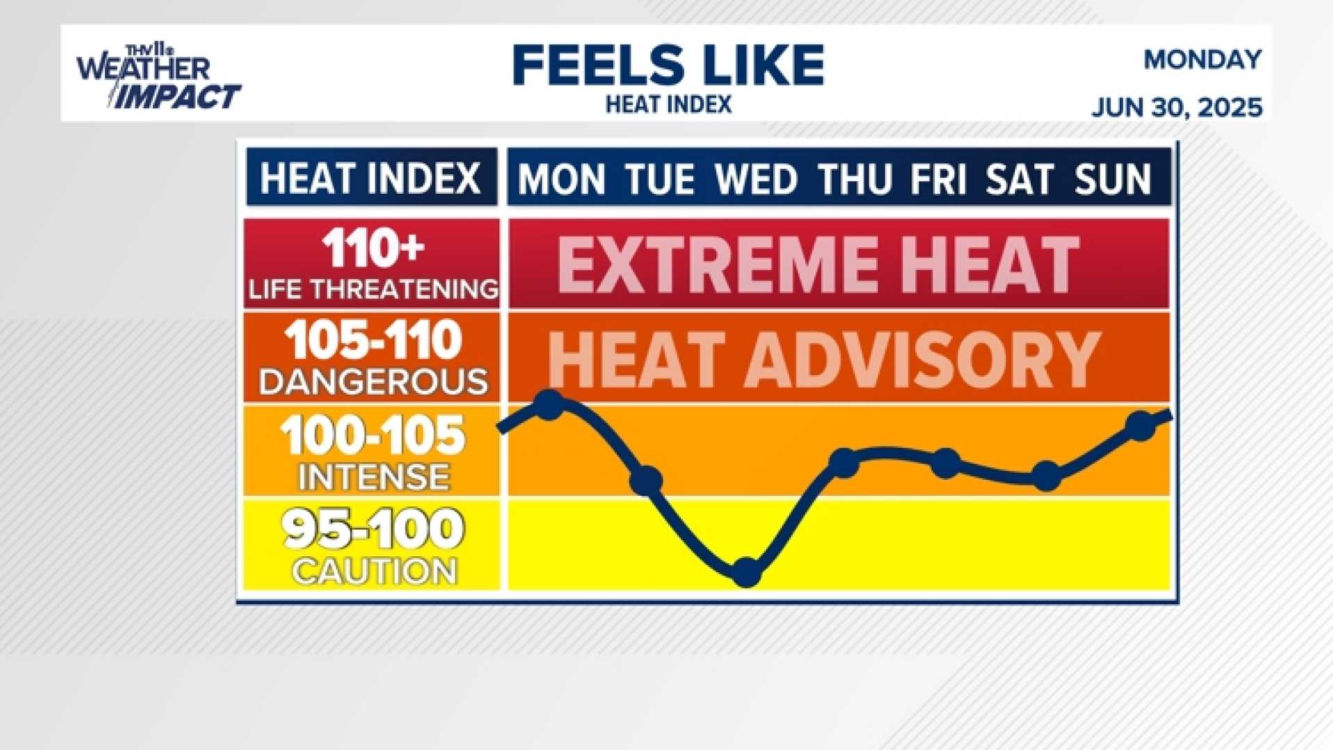
COLUMBIA, S.C. (WIS) – Heat and humidity returned strongly this afternoon, with temperatures in the mid to upper 90s. A heat advisory has been issued for much of the region.
The ‘feels-like’ temperatures, factoring in humidity, are expected to reach triple digits today. A few isolated showers or thunderstorms could develop this afternoon, although overall rain chances remain low at 20%.
“It’s typical summertime heat and humidity,” said a weather spokesperson. “Be prepared for an afternoon storm, especially later in the week.”
Tuesday is also predicted to be hot and humid, with a 30% chance of afternoon thunderstorms. The Storm Prediction Center has issued a Level 1 of 5 ‘Marginal’ risk of severe weather for parts of the Midlands, indicating potential gusty winds and small hail.
Rain chances will continue to rise later in the week as an upper-level disturbance approaches the Eastern Seaboard. Daily scattered showers and thunderstorms are likely by Wednesday, with a 50% chance of rain.
Residents in Greater Boston can expect highs in the low to mid-90s today, while central and western Massachusetts see highs around 90. Southeastern Massachusetts should anticipate highs in the 80s, with humid conditions carrying into Tuesday.
In New Hampshire, a heat advisory is in effect for Monday, with forecasts suggesting highs around 90 degrees. Scattered showers and storms are likely on Tuesday.
As we approach Friday, the threat of unsettled weather increases. Temperatures might dip slightly, providing some relief from oppressive humidity.
This week is expected to be mainly hot and humid with daily storm chances, particularly on Tuesday, Thursday, and Friday.


