News
Low Flood Risk for Houston Amid Scattered Showers
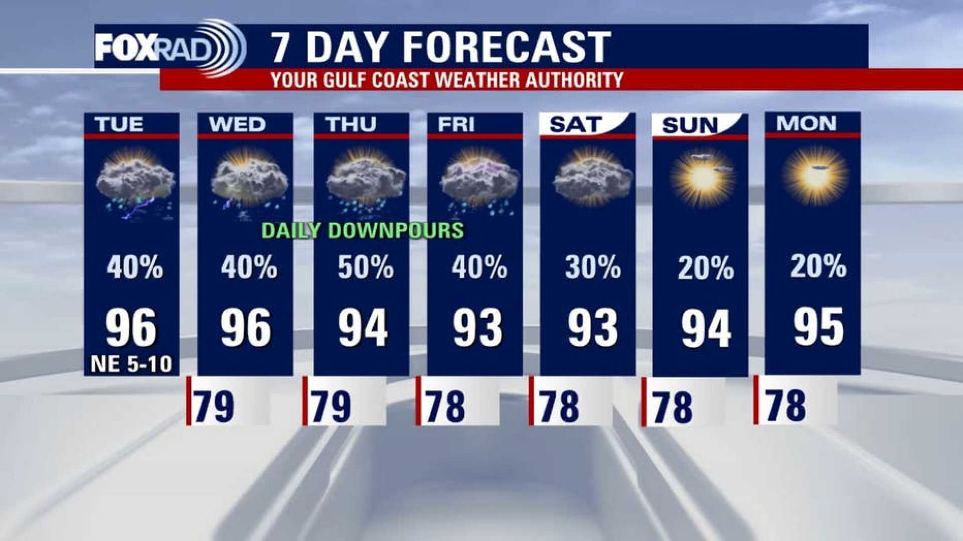
HOUSTON – A low flood risk exists due to scattered downpours expected on Thursday. Afternoon temperatures will reach the mid-90s. While Hurricane Erin is not making direct landfall in the U.S., the storm could generate large waves and some coastal flooding from Florida to North Carolina.
The weather pattern remains stable, with more afternoon and evening storms likely to develop. Some storms may be heavy enough to produce up to 2 inches of rain, which might cause brief street flooding if the rainfall is intense.
This weekend, a shift in the weather is anticipated as high pressure builds in. Saturday could bring fewer storms, transitioning to a sunnier pattern. Temperatures are expected to soar into the upper 90s, and the heat index might reach as high as 105 degrees.
Hurricane Erin has been downgraded to a category 2 storm, with maximum winds near 100 mph. It is currently situated well offshore North Carolina and Virginia, posing no direct threat.
Weather experts are also monitoring two other tropical waves in the Atlantic. One has a high chance of developing into a tropical storm, but is not projected to impact the Texas Gulf Coast. A second wave in the eastern Atlantic could develop next week, but for now, conditions in Texas remain stable.


