News
Northeast Faces Flood Threat as Weather Cools Down
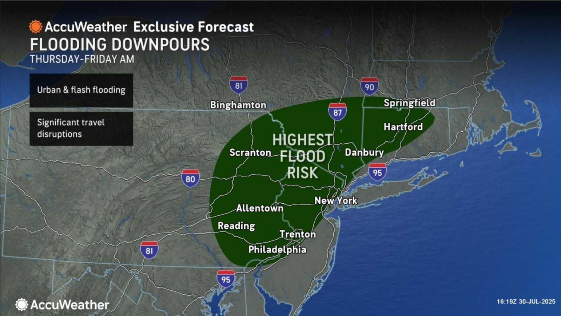
NEW YORK, N.Y. — A significant flash flood threat is expected across the Northeast on Thursday as a cold front moves into the region. This weather change comes after several days of sweltering heat that has affected many areas.
The cold front, combined with humid air from earlier in the week, will trigger numerous showers and thunderstorms. These storms could produce heavy rainfall in various locations, particularly in southern New England, the New York tri-state area, and the mid-Atlantic. Flash flooding is a concern this afternoon and evening where the heaviest downpours occur.
Localized rainfall totals could reach 4 to 6 inches in some areas. The National Weather Service has issued flood watches for cities including Baltimore, Hartford, New York City, Philadelphia, and Washington, D.C. Additionally, damaging wind gusts may accompany severe storms in the mid-Atlantic.
Travelers should expect delays, especially during the afternoon and evening hours, due to the anticipated rain. It is crucial to avoid driving through flooded roads, as just 1 foot of water can float a car or small SUV.
On a brighter note, the weather is expected to improve significantly this weekend. With high pressure bringing drier air into the region, humidity levels will drop. Highs will range from the mid-70s in Boston to the lower 80s in New York and Washington, D.C. Sunday should also see similar temperatures while keeping low humidity.
Low temperatures in the mornings are predicted to be much more comfortable, ranging from the 50s in New England to the lower or middle 60s in southern areas.


