News
Possible Tropical Development Off the Southeast Coast This Weekend
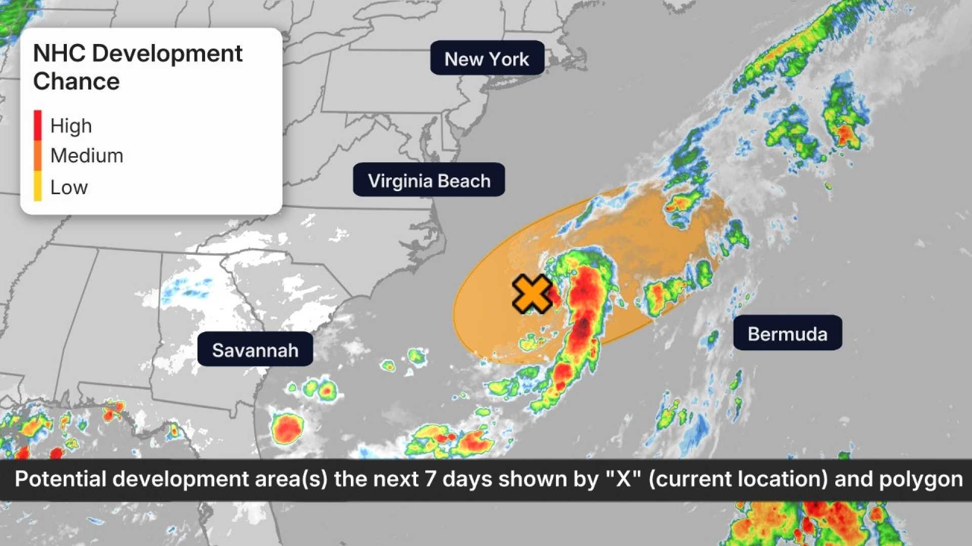
SAVANNAH, Ga. – A slow-moving cold front is expected to bring rainy weather and potential tropical development to the Southeast coast over the next few days. An area of low pressure could form along the frontal boundary, with the National Hurricane Center monitoring the situation closely.
Forecasters believe the formation of a tropical depression or storm is possible as early as Sunday or Monday. The region is climatologically favored for such development during this time of year. Regardless of tropical activity, the cold front will pool moisture, raising the risk of flooding in Alabama, Georgia, South Carolina, and Tennessee this weekend.
According to meteorologists, areas of coastal Georgia and southern South Carolina could see significant rainfall, with accumulations of 3 to 6 inches possible. The next named storm would be called “Dexter.” The forecast also notes that as the front stalls, rounds of showers and thunderstorms will spread from eastern Louisiana to eastern North Carolina.
AccuWeather Lead Hurricane Expert Alex DaSilva stated, “The good news is that if anything develops, it is likely to move away from the U.S.” However, he cautioned beachgoers to stay alert for rough surf and rip currents as storm activity increases.
Moreover, another tropical wave off the coast of Africa is being monitored. It may approach the Lesser Antilles mid to late next week, although conditions are marginal for development at this time.
As the Atlantic hurricane season progresses, experts are noting a historical increase in tropical activity over the next 4-6 weeks. The current season has seen three named storms already, with the average date for the formation of the third storm typically occurring in early August.
The National Hurricane Center has highlighted the importance of staying informed as weather patterns evolve over the next week, especially as the Southeast prepares for a prolonged period of soggy weather and potential flooding.


