News
Potential Tropical Storm Could Bring Heavy Rain to Gulf Coast
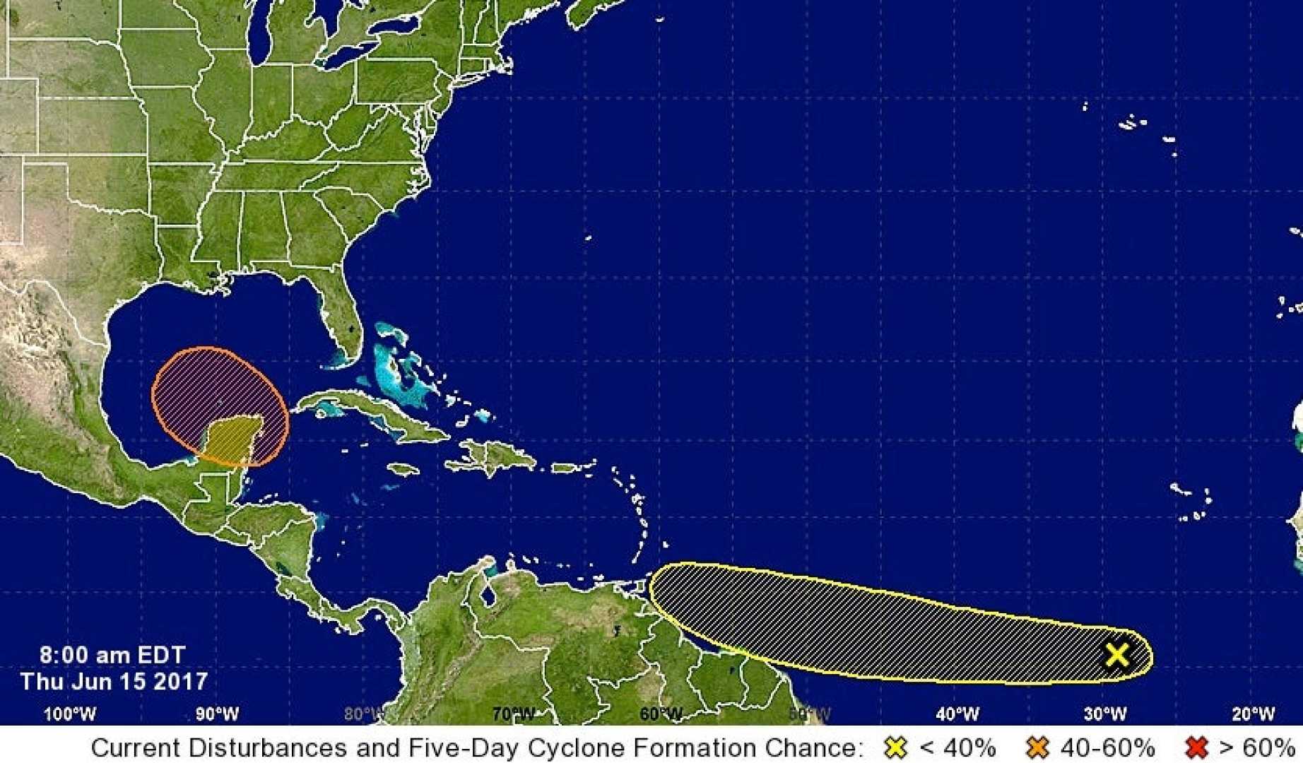
MIAMI, Florida — A system of storms is currently unorganized off the coast of Florida, raising concerns about the possibility of a new tropical system this week. According to the National Hurricane Center, the area of showers and thunderstorms is expected to drift west into the Gulf of Mexico by midweek, with a medium chance of developing into a tropical depression.
If the system strengthens and forms a defined center, it could be named Dexter, making it the fourth named storm of the Atlantic hurricane season, which typically peaks around mid-August. Warmer water in the Gulf is ideal for storm development, as it provides the fuel needed to strengthen storms.
However, current conditions may not favor the formation of a strong tropical system. The storm is expected to have limited time over open waters and will face upper-level winds that could disrupt its development. Yet, some forecasting models suggest that the system could still organize into a tropical storm by late week, depending on its track and speed.
Regardless, Florida and parts of the Gulf Coast should prepare for increased rainfall this week. Daytona Beach already experienced a record-breaking 2.25 inches of rain on Tuesday, surpassing a previous daily record from 1935. The potential for flooding is heightened, especially in central Florida, with a Level 2 flood risk in places like Tampa and Orlando on Wednesday.
The heaviest rainfall is predicted for the end of the week, particularly in the north-central Gulf Coast states, such as Alabama, Mississippi, and Louisiana. A Level 3 flood risk will be in effect for parts of Louisiana, including Baton Rouge, due to concerns about lingering heavy rain.
Flash flooding remains a significant concern as prolonged rain bands could affect the same areas. With many uncertainties still in play regarding the storm’s intensity and trajectory, officials recommend residents in flood-prone regions stay alert and prepared for sudden changes in weather.