News
Severe Storms Hit North Texas as Heat Returns Next Week
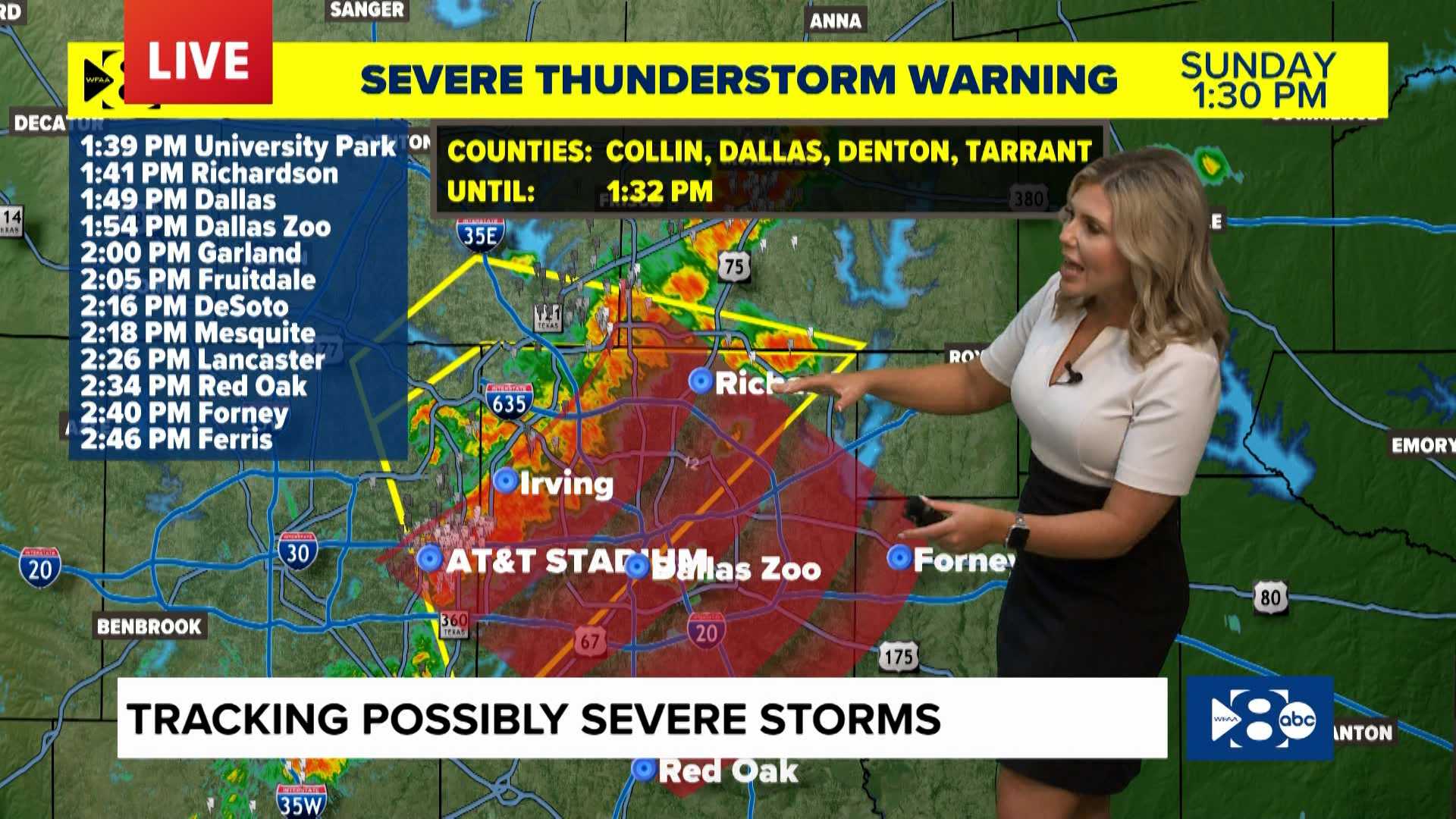
DALLAS — Heavy rain and severe storms swept across North Texas on Sunday, bringing gusty winds and a chance for hazardous conditions. The storms are expected to continue through the night, with more rain projected for Monday morning.
Storms originating from Oklahoma began moving into the region late Sunday, creating a marginal risk for severe weather, particularly in the DFW metroplex. Meteorologists have warned of wind gusts reaching up to 60 mph, with the strongest winds expected west of the metroplex, potentially hitting 70 mph.
“The highest threat of severe weather will occur overnight into Monday morning, which could affect the morning commute,” said a meteorologist from WFAA. The storms are expected to reach the metroplex by 6 AM, causing heavy rain just as the morning rush hour begins.
Temperatures at DFW Airport dropped significantly during the storm, registering a high of 96 degrees on Friday, though conditions cooled slightly following the rains. Over 11,000 customers were reported without power due to the storm’s impact.
By early next week, a strong ridge of high pressure, referred to as a heat dome, will move into Texas, likely leading to a return to hot and dry weather with temperatures climbing back toward the triple digits by Thursday.
Before the dryness returns, another system is expected to move into the region overnight. “Individuals should plan for possible delays during their morning commute due to the rain and potential traffic impacts,” added the meteorologist.
As summer continues, temperatures throughout North Texas are expected to hover in the low 90s on Sunday, with high humidity contributing to higher heat index values.
After Monday, rain chances will diminish, returning the area to its typical dry August conditions.


