News
Severe Weather Watch Issued for Big Bend and South Georgia Amid Storm Threat
TALLAHASSEE, Fla. (WCTV) – A Severe Thunderstorm Watch is in effect for much of the Big Bend and South Georgia until 6 p.m. Monday, as meteorologists track the potential for strong to severe storms across the region.
The National Weather Service has identified a Level 3 Enhanced Risk for severe weather in these areas. The severity of the storms is considered conditional, meaning that the presence of persistent cloud cover may reduce the available energy for storm development, while clearing skies could lead to increased storm intensity.
The primary threat associated with these storms is expected to be strong, straight-line winds. Isolated tornadoes cannot be ruled out, and residents are urged to stay vigilant throughout the day.
The timing for the most severe weather is anticipated between 1 p.m. and 7 p.m., making it crucial for individuals to remain informed and prepared. “We’re monitoring the situation closely and will keep our viewers updated on the latest developments,” said WCTV Meteorologist Rob Nucatola.
To assist residents in staying informed, WCTV has launched the First Alert Weather app, which provides real-time updates, push alerts, and access to live radar. This resource is particularly important during severe weather events.
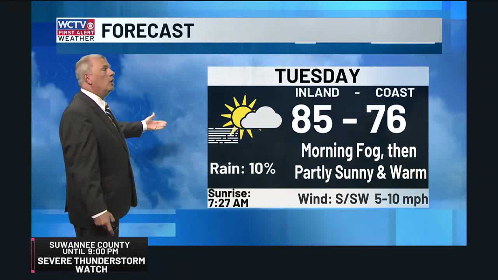
As the storms move through, warmer temperatures are expected to lead to dry weather in the following days. After Monday’s storms, a decrease in precipitation is anticipated with overnight lows remaining in the mid-60s, according to meteorological reports.
Looking ahead to the middle of the week, forecasters predict predominantly sunny conditions, with temperatures rising into the upper 80s as high pressure builds over the region. “If you enjoy warm weather, you’ll likely be pleased with the outlook for the latter part of the week,” Meteorologist Cameron Aaron noted.
Although temperatures may flirt with the 90-degree mark in some areas, overnight lows are expected to remain comfortable in the low-to-mid-60s.
As next weekend approaches, residents can expect similar warm conditions, though an incoming weather system could bring more moisture by Sunday and Monday.
WCTV encourages everyone to follow their updates for the latest information and advisories as the weather situation evolves.


