News
Southeast Michigan Faces Intense Heat and Possible Thunderstorms
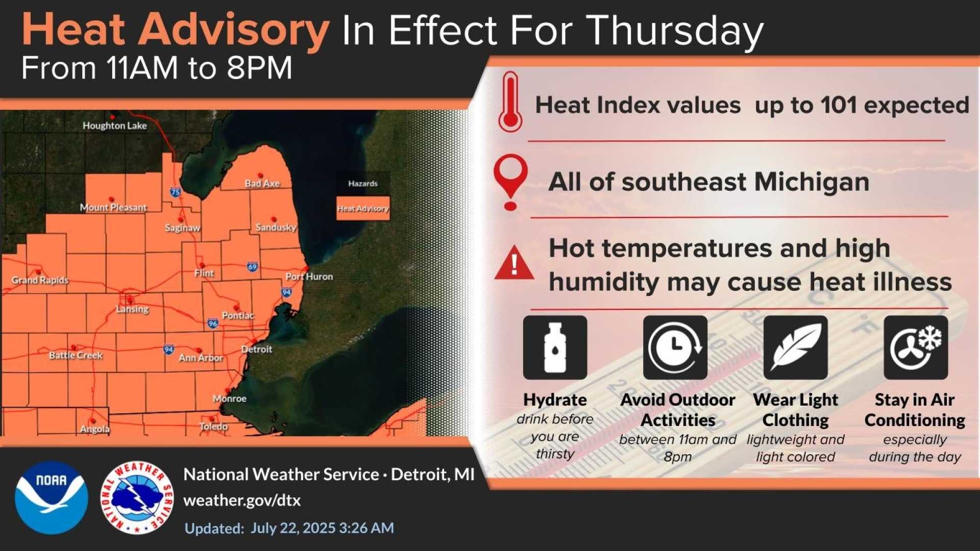
DETROIT, Michigan—Southeast Michigan is under a 4Warn Weather Alert due to dangerously high heat and humidity expected on Thursday. A Heat Advisory remains in effect across the region until 8 p.m., with heat index values reaching up to 105 degrees.
Meteorologists warn that young children, older adults, and those with health conditions are at heightened risk for heat illness. They recommend staying hydrated, wearing light clothing, and taking breaks from outdoor activities.
Temperatures are expected to peak in the mid-90s on Thursday afternoon, with evening temperatures lingering in the 80s. The warm conditions will create the perfect environment for isolated thunderstorms, some of which could become severe, bringing heavy rainfall and gusty winds up to 60 mph.
Residents should seek shelter indoors from both the heat and any approaching storms. The risk for severe thunderstorms is categorized at level one out of five, indicating possible stronger storms before midnight.
Rain showers and thunderstorms are forecasted to continue into the night, with overnight temperatures between 70 and 74 degrees. Winds will shift to the west at 5 to 10 mph, with gusts up to 20 mph.
Friday is expected to offer slightly cooler temperatures in the mid-to-upper 80s, but high humidity will persist. An Air Quality Alert has also been issued for Sanilac County due to wildfire smoke affecting air quality across various regions.
Saturday is anticipated to be a temporary relief, with partly sunny skies and a chance of scattered rain showers. However, the heat is set to return on Sunday, with temperatures climbing back to near 90 degrees.
Next week is projected to continue with warm, muggy conditions and intermittent rain chances.


