News
Storms Forecasted for Omaha as Heat Builds Midweek
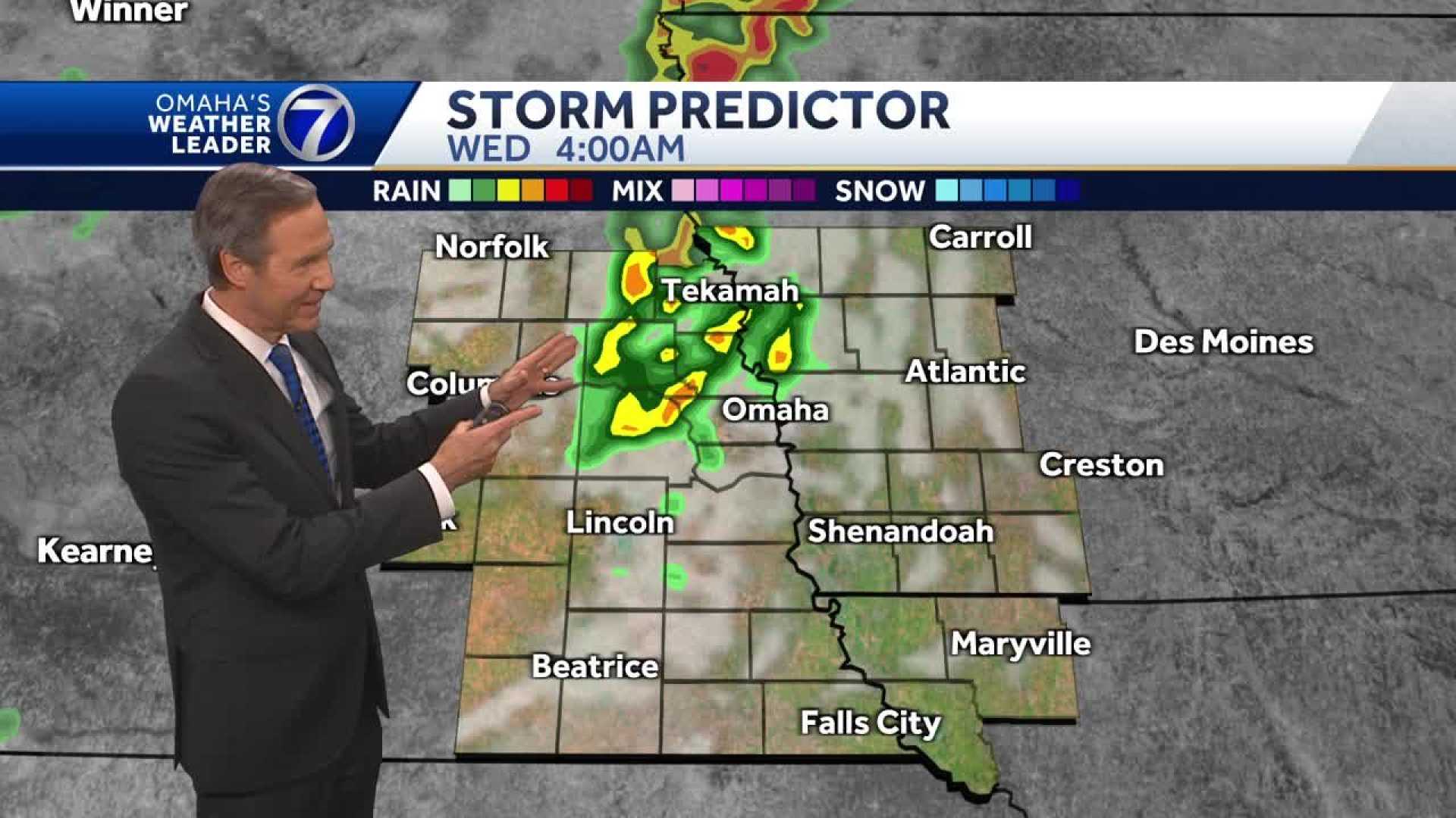
OMAHA, Neb. — Omaha‘s Weather Leader has declared Wednesday an impact weather day as storms are expected to roll through the area. Residents should prepare for potential storm impacts during the morning commute, especially before 10 a.m.
The Storm Prediction Center (SPC) has placed most of eastern Nebraska and southwest Iowa under a marginal risk for severe storms. Meteorologists warn of strong winds, possible hail, and heavy rainfall associated with any stronger storms today.
Early this morning, residents in the Omaha metro may experience the highest chance of storm activity. The leading edge of these storms is moving south from the Denison area in Iowa, approaching the Carroll region. There are potential wind gusts up to 50 mph, along with heavy rainfall and flashes of lightning.
“The best storm chances will be from the Omaha metro to the east,” said a meteorologist. “Expect a wet drive with the most significant impact anticipated between 7 a.m. and 9 a.m.”
As the day progresses, the weather is expected to clear up in the afternoon, with temperatures climbing to the mid to upper 80s. However, there could still be lingering showers. Later tonight, some isolated storms may pop up, especially east of the Omaha metro.
Looking ahead, Omaha’s Weather Leader is also keeping an eye on potential storm activity this weekend as a front approaches. Friday is predicted to be notably hot, with temperatures nearing 95 degrees and heat indices hitting between 100 and 105 degrees.
For the latest updates, residents are encouraged to download the KETV mobile app for real-time weather alerts and updates.


