News
Storms Threaten Chicago Area with Tornado and Severe Thunderstorm Watches
CHICAGO, IL – A tornado watch has been issued for Kenosha County as severe thunderstorms move through the Chicago area. According to the National Weather Service, the watch is in effect until 6 p.m. and encompasses much of Wisconsin, while severe thunderstorms are already impacting the western part of the state.
In addition to the tornado watch, a severe thunderstorm watch remains for northern Illinois, including Chicago, until 8 p.m. This includes counties such as McHenry, Lake, DeKalb, Kane, DuPage, and Cook, among others. A severe thunderstorm warning is currently active for Cook County until 4:15 p.m., with strong storms expected to move east towards the city at approximately 35 miles per hour.
Officials reported that these storms have caused damage from high winds in DuPage County, with gusts reaching up to 65 miles per hour. As of 3:30 p.m., a severe storm located near Gardner produced wind gusts exceeding 60 miles per hour.
Lake and Porter counties in Indiana are also under a severe thunderstorm warning until 5:15 p.m. The storms there could generate wind gusts in excess of 60 miles per hour along with penny-sized hail. The current line of storms is moving eastward at speeds around 55 miles per hour.
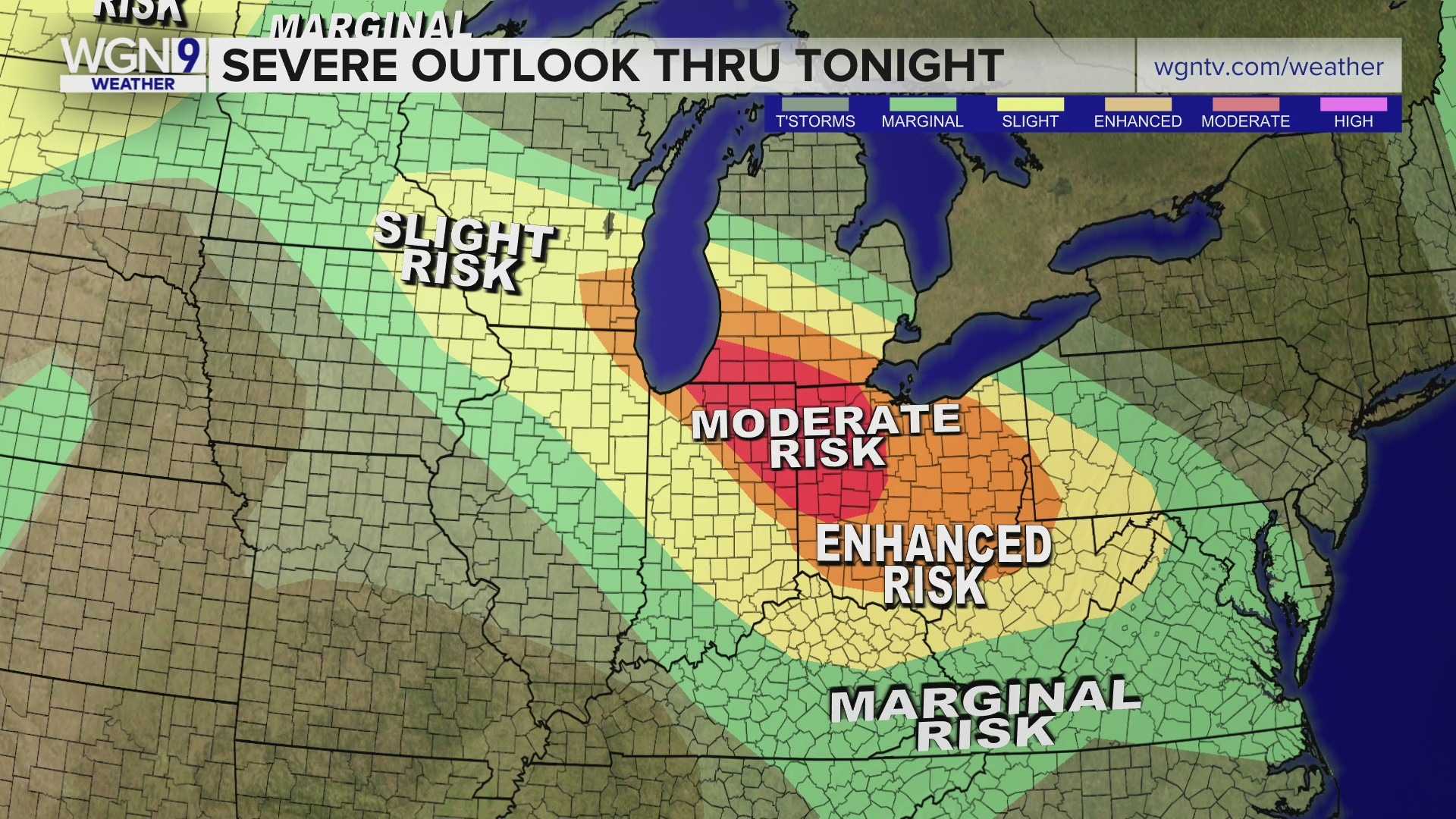
The Storm Prediction Center classifies most of the Chicago area under a “slight” risk for severe weather, indicating that gusty winds over 60 to 70 miles per hour are likely. Forecast models also suggest a non-zero risk of tornadoes in the area, especially in the western suburbs where damaging hail could occur.
Heavy rain is expected with some localized flooding possible as the low-pressure system moves through. Following the storm, temperatures across the Chicago area are forecasted to cool off, with highs in the mid- to upper 70s anticipated on Thursday.
Residents and travelers are advised to stay alert and monitor weather updates as the storms approach.


