News
Tropical Storm Erin Raises Concerns for Florida Amid Stifling Heat
ORLANDO, Fla. – As Florida swelters under extreme heat, Tropical Storm Erin is becoming a significant weather concern. On Friday, August 15, 2025, Central Florida experienced dangerous heat, with heat index values soaring to between 105 and 110 degrees, prompting a Heat Advisory that remains in effect until 7 p.m.
Despite lower-than-normal chances of storms due to drier air, there is still potential for strong storms developing west of Interstate 95. Meteorologists expect gusty winds reaching up to 55 mph, heavy rains, lightning, and possible small hail.
The weekend rainfall and storm chances are projected to rise to between 50 and 70 percent as areas of high pressure weaken. Most storm activities will occur inland, although coastal regions may also experience some action as sea breezes develop. Even with the anticipated rainfall, oppressive heat is expected to continue, with ‘feels-like’ temperatures hovering near 110 degrees.
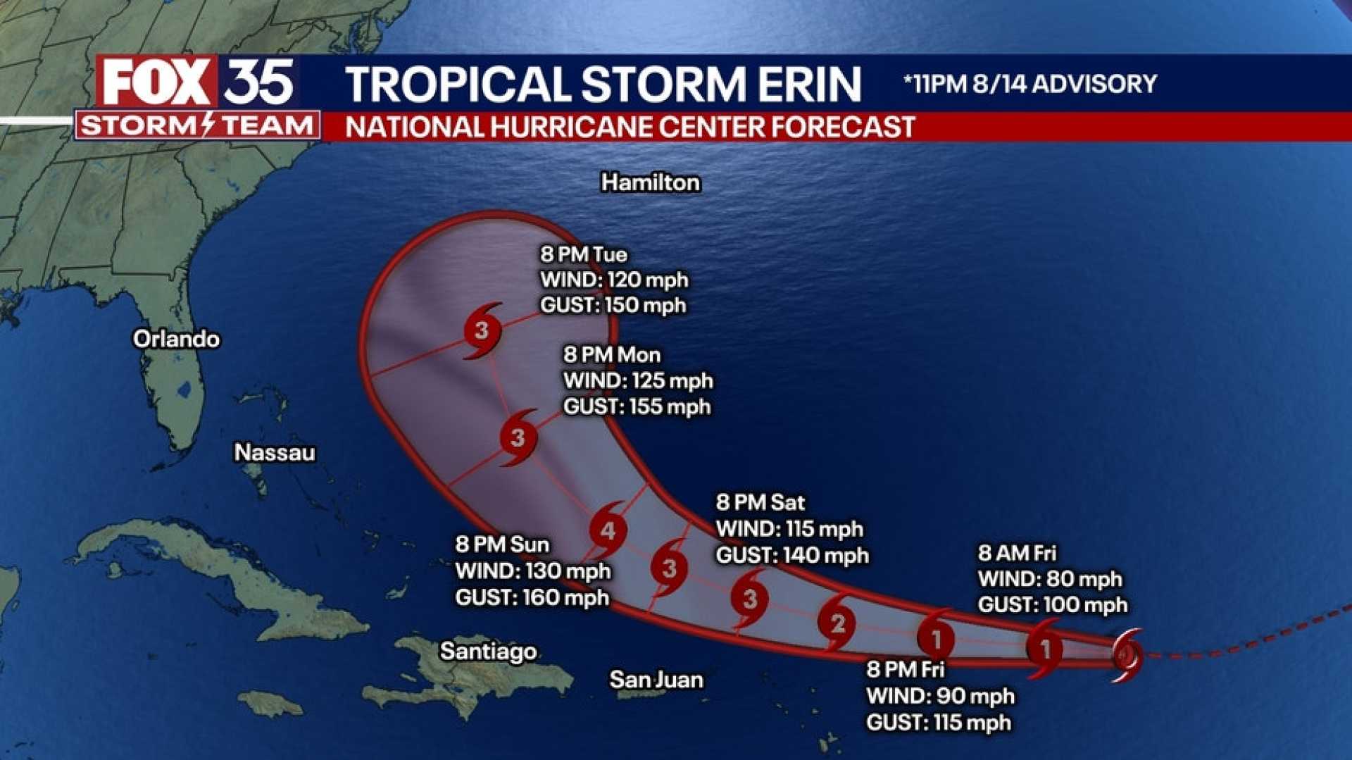
Concerning Erin, the tropical storm is currently predicted to remain offshore due to the high-pressure system that is currently enveloping Florida. This high pressure has brought oppressive heat but is also directing Erin back out to sea, diminishing the likelihood of direct impacts in Florida.
Beginning Monday, swells from Erin are expected to create dangerous surf and rip currents along the East Coast. Beachgoers are advised to monitor beach flags and swim near lifeguards, even on sunny days.
According to meteorologists, Erin became the first named hurricane of the Atlantic season on Friday, with maximum sustained winds recorded at 75 mph. Rapid strengthening is predicted in the coming days, leading Erin to potentially evolve into a major hurricane.
The high-pressure system affecting Florida and steering Erin will weaken and shift east early next week, ensuring some relief from the heat and allowing the storm to curve away from the U.S. East Coast.
If Erin maintains its current path offshore, it is likely to generate dangerous rip currents along Florida’s Atlantic beaches as large outdoor events are planned in the area. Residents are reminded to stay aware of their local weather updates through the weekend.


