News
Severe Rainfall Causes Flooding Across New Jersey and Pennsylvania
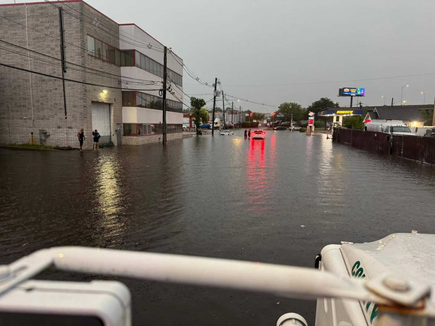
Trenton, New Jersey — Severe thunderstorms delivered heavy rainfall to parts of New Jersey and Pennsylvania this week, prompting state officials to declare emergencies in flooded areas. Reports indicated that northern New Jersey experienced as much as 6.5 inches of rain, while adjacent regions like Philadelphia received varying totals.
On Thursday, storm systems hammered South Jersey, particularly targeting Long Beach Island, leading to significant flooding. Paul Fitzsimmons, a lead meteorologist at the National Weather Service in Mount Holly, described the week’s weather as “unsettled,” adding, “We have one day that’s a little better, then go back to a day that’s a little worse, on and on.” The forecast for the weekend showed little promise of relief, with a strong likelihood of continued showers.
The North Jersey area faced the brunt of the storms, leading to a statewide emergency declaration. While places like Stafford Township reported over 4 inches of rain, nearby communities saw drastically different totals, with some areas measuring less than half an inch. In Philadelphia, rain amounts averaged about 1.3 inches, whereas some neighboring counties recorded 1 to 2 inches.
Dave Dombek, a senior meteorologist with AccuWeather, noted that many regions are “stuck in the muck for a while.” He remarked that the saturated atmosphere could lead to additional flooding as thunderstorms continue to develop unpredictably.
Weather models predict another major surge of rain could arrive by Wednesday night, raising further concerns about flash floods. The National Weather Service has issued a 70% chance of measurable rain on Wednesday, with forecasts looking similar through the weekend.
In Chester County, rainfall totals were particularly disparate, with some areas reporting as much as 5 inches while others saw only a mere sprinkle. This scenario is common during summer thunderstorms, as Robert Shedd, chief hydrologist at the Middle Atlantic River Forecast Center, explained. “With thunderstorms, you can get 2 inches in one place, and two miles away, you could have a quarter inch,” he said.
Meteorologists attribute these localized storms to weak steering winds, which can cause them to “train,” or repeatedly hit the same area. This makes forecasting challenging, as predictions may not accurately represent the specific locations that will receive heavy rain.
As weather authorities continue to monitor the situation, residents are advised to prepare for ongoing storm patterns and keep umbrellas handy. The importance of improved weather observation systems, such as expanding weather balloon networks, has been highlighted as a means to better predict and understand these phenomena.
Local officials remain vigilant as they navigate the unusual atmospheric conditions that have caused significant rainfall this week. New Jersey’s Department of Environmental Protection and the National Weather Service are working to manage the ongoing risks associated with these unpredictable summer storms.


