News
Severe Storms Sweep Through Minnesota, Warnings Issued for Twin Cities
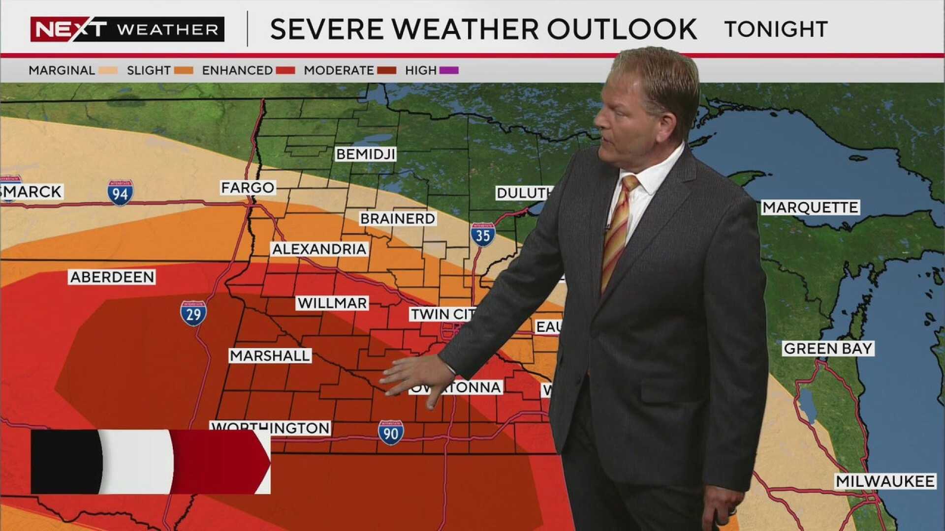
MINNEAPOLIS, Minnesota – Severe storms with damaging winds are moving through west-central Minnesota Monday evening. Meteorologist Chris Shaffer announced that the system is on track to reach the Twin Cities by approximately 9:30 p.m.
The National Weather Service has issued a severe thunderstorm warning covering the Twin Cities, including Minneapolis and St. Paul. This warning is set to expire at 10:30 p.m. In addition, warnings are in effect for parts of the west metro area, including Carver, Hennepin, Wright, and McLeod counties, until 10 p.m.
The storms are moving east at about 35 mph and are predicted to produce small hail, winds up to 50 mph, and heavy rainfall. In reports from western Minnesota, winds have already reached 60 mph accompanied by nickel-sized hail.
A cluster of strong storms has formed a line west-northwest of the Twin Cities. This line poses a threat of winds exceeding 50 mph. The National Weather Service has issued special weather statements for parts of western Minnesota, including Alexandria and Melrose, confirming the oncoming severe weather.
FOX 9 Chief Meteorologist Ian Leonard highlighted that storms are rapidly developing across central South Dakota and are expected to gain strength as they move eastward. Leonard warned that a high-impact wind event known as a derecho is possible, which could result in damaging winds, isolated tornadoes, and heavy rainfall as these storms push through.
Public safety officials advise individuals to prepare for adverse weather conditions, as the strongest storms will likely occur between 10 p.m. and 3 a.m. Tuesday. The organization stresses the importance of having multiple ways to receive weather alerts as conditions may worsen overnight.
By Tuesday, temperatures are expected to drop into the 70s with improved conditions following the storms.


