News
Tropical Storm Fernand Forms, But No Threat to U.S.
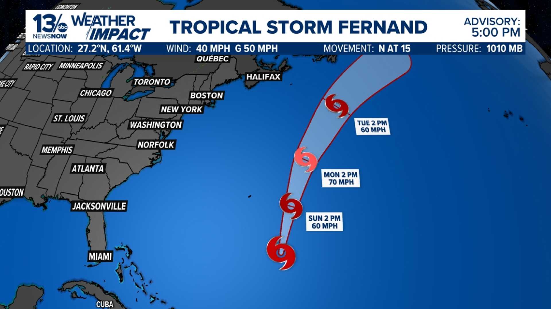
FORT MYERS, Fla. — Tropical Storm Fernand has formed in the Atlantic Ocean just days after Hurricane Erin. The storm, pronounced fair-NAHN, became the sixth storm of the 2025 Atlantic hurricane season late Saturday afternoon when a Hurricane Hunter mission discovered a low-pressure circulation with thunderstorms.
Fernand is currently located several hundred miles south-southeast of Bermuda and is expected to move north. Fortunately, meteorologists report that the storm poses no threat to the U.S. or Caribbean over the next few days.
The National Hurricane Center (NHC) forecasts that Fernand will curl north and then northeast in the coming days, which should keep the storm well east of Bermuda and eventually southeast of Newfoundland, Canada. By that time, it is expected to become a non-tropical low over the northern Atlantic.
According to the forecast, Fernand could strengthen through Monday due to warm waters and limited shearing winds, potentially becoming the season’s second hurricane by late Sunday or Monday.
Meanwhile, another system tagged as Invest 90L is located a few hundred miles west of the Lesser Antilles. The NHC estimates an 80% chance of development for this area over the next two days, possibly leading to the formation of a tropical depression or storm by this weekend.
On the other hand, Invest 99L, a tropical wave in the central Atlantic, is less likely to develop, carrying a 30% chance of becoming a tropical system. This system is expected to drift westward without posing any risk to North America.
Hurricane Erin, meanwhile, is now classified as a post-tropical cyclone and will not prompt further advisories. Though categorically post-tropical, Erin is still producing wind gusts up to 90 mph as it continues east-northeastward into the northern Atlantic.


