News
Hurricane Erin Strengthens to Category 4 in the Atlantic
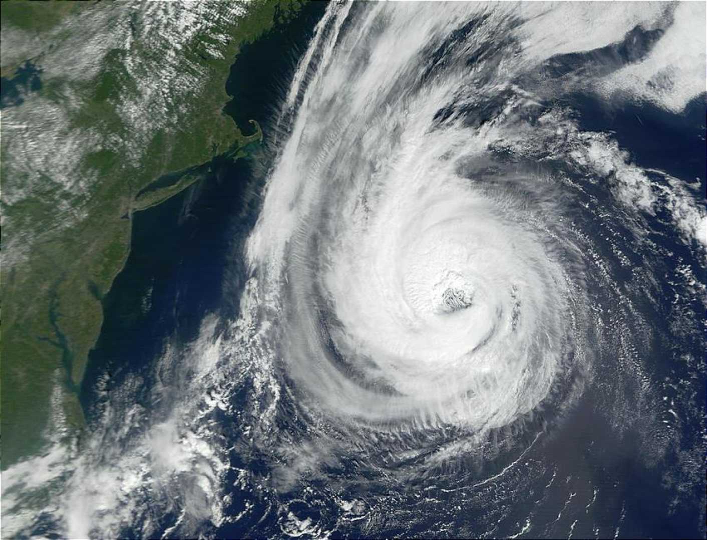
MIAMI, FL – Hurricane Erin has rapidly intensified into a Category 4 storm as it approaches the northeastern Caribbean, causing concern for heavy rain, strong winds, and rough surf this weekend. As of Saturday morning, the National Hurricane Center reported Erin’s sustained winds at 130 mph, located about 150 miles northeast of Anguilla.
The storm is moving west-northwest and is expected to pass just north of the Leeward Islands, the Virgin Islands, and Puerto Rico, prompting tropical storm watches for the region. Although a direct hit is unlikely, meteorologists warn of potential flash flooding and mudslides due to heavy rain.
Forecasters indicate that Erin will continue to strengthen through Saturday, potentially doubling in size as it moves over warmer-than-normal waters in the western Atlantic. Jack Beven, a senior hurricane specialist at the National Hurricane Center, noted that rapid intensification occurs when a storm’s winds increase by 35 mph within 24 hours.
The U.S. Coast Guard has announced the closure of ports in the U.S. Virgin Islands and Puerto Rico to all inbound vessels due to the anticipated impacts of Erin. Fluctuating wind and rain, coupled with rough seas, are expected to last into early next week.
Residents in affected areas may see rainfall amounts between 2 and 4 inches, with localized totals reaching up to 6 inches in heavier downpours. Experts warn that these rainfall amounts could lead to severe flooding, particularly in hilly or mountainous areas.
While Erin is forecast to turn north and move away from the U.S. and Bermuda, coastal areas could still experience dangerous surf and rip currents. Authorities are urging beachgoers to avoid swimming in potentially hazardous conditions.
This is Erin’s first hurricane season appearance, following several tropical storms earlier this year that did not reach hurricane status. The storm’s path and intensity will continue to be monitored, with updates expected as weather conditions evolve.
Erin’s formation exemplifies the impact of climate change, with warmer oceans contributing to more extensive and powerful hurricanes.


