News
Rain and storms return Monday amid warm temperatures
WASHINGTON — Rain and storms are expected to return to the East Coast as early as Monday, bringing changes to the warm weather pattern. Forecasts indicate mostly sunny skies with isolated afternoon showers, leading to highs between 85 and 90 degrees.
On Sunday, residents can expect partly to mostly sunny conditions. High temperatures will reach 84 to 89 degrees, with southern wind speeds of 5 to 10 mph. While there may be a chance of scattered showers overnight, much of the day is likely to remain dry.
The tropical disturbance off the coast of South Carolina poses an increased risk for rip currents, prompting officials to advise beachgoers to exercise caution.
Next week is anticipated to be much soggier, with isolated storms expected. Tropical Storm Chantal is noted to be forming in the Atlantic, moving toward the Carolinas and threatening heavy rain Saturday and Sunday.
Across the Midwest, weather conditions are expected to shift with rising temperatures and humidity. Topeka, Kansas is experiencing hotter weather today, though no rain is in the forecast. A chance for showers and storms is set to return, especially through the Independence Day weekend, though specific details are still developing.
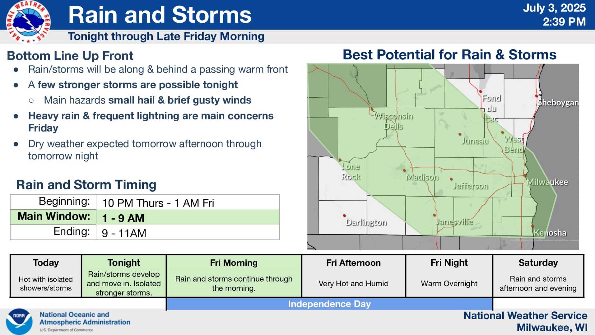
Further north in Wisconsin, showers and storms will pass through while windy conditions are expected with gusts reaching up to 40 mph. The upcoming week will also include the possibility of locally heavy rainfall and lightning.
As weather patterns develop, residents are advised to check forecasts regularly and stay updated on any changes that could affect outdoor plans.


