News
Tropical Depression Three Forms Off Southeast Coast, Aims for Carolinas
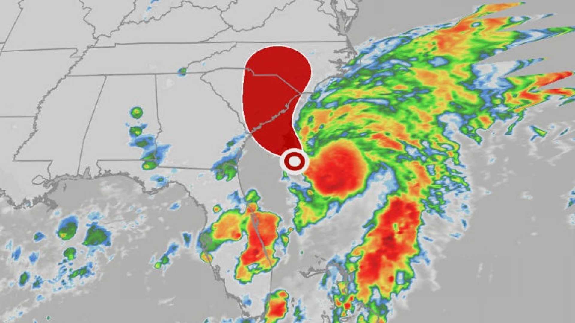
ORLANDO, Fla. — Tropical Depression Three formed off the Florida and Georgia coast late Friday afternoon, marking the third system of the Atlantic hurricane season, according to the National Hurricane Center (NHC). The storm is not expected to pose a significant threat to land, but it may produce heavy rainfall and risky beach conditions in parts of the Southeast over the weekend.
As of 5 p.m. Friday, the storm has sustained winds of 35 mph and is located about 150 miles south-southeast of Charleston, South Carolina. Forecasts indicate the system could strengthen and be designated as Tropical Storm Chantal by Saturday.
A Tropical Storm Watch has been issued for the South Carolina coast, stretching from Edisto Beach to Little River Inlet. The storm’s slow northward movement at only 2 mph is expected to continue Friday night before shifting northwest on Saturday. Landfall along the South Carolina coast is likely by early Sunday.
Forecasters predict that Tropical Depression Three could generate multiple rounds of thunderstorms, leading to rainfall totals of 2 to 4 inches in the Carolinas, with some areas possibly receiving up to 6 inches by Monday. Additionally, storm surge of 1 to 2 feet may occur in regions with strong onshore winds. Coastal communities are urged to remain cautious of rough surf and rip currents throughout the holiday weekend.
Beyond the Southeast, most areas of the country will enjoy clear, calm weather for the July 4th weekend, particularly in the Northeast and West. However, Texas and the Upper Midwest may experience strong thunderstorms with potential for damaging winds and hail.
With the early arrival of rainfall, several rivers in the Southeast are already overflowing, flooding nearby campgrounds and homes. The NHC will provide continuous updates as Tropical Depression Three progresses.


