News
National Hurricane Center Monitoring Possible Tropical Development Off Florida Coast
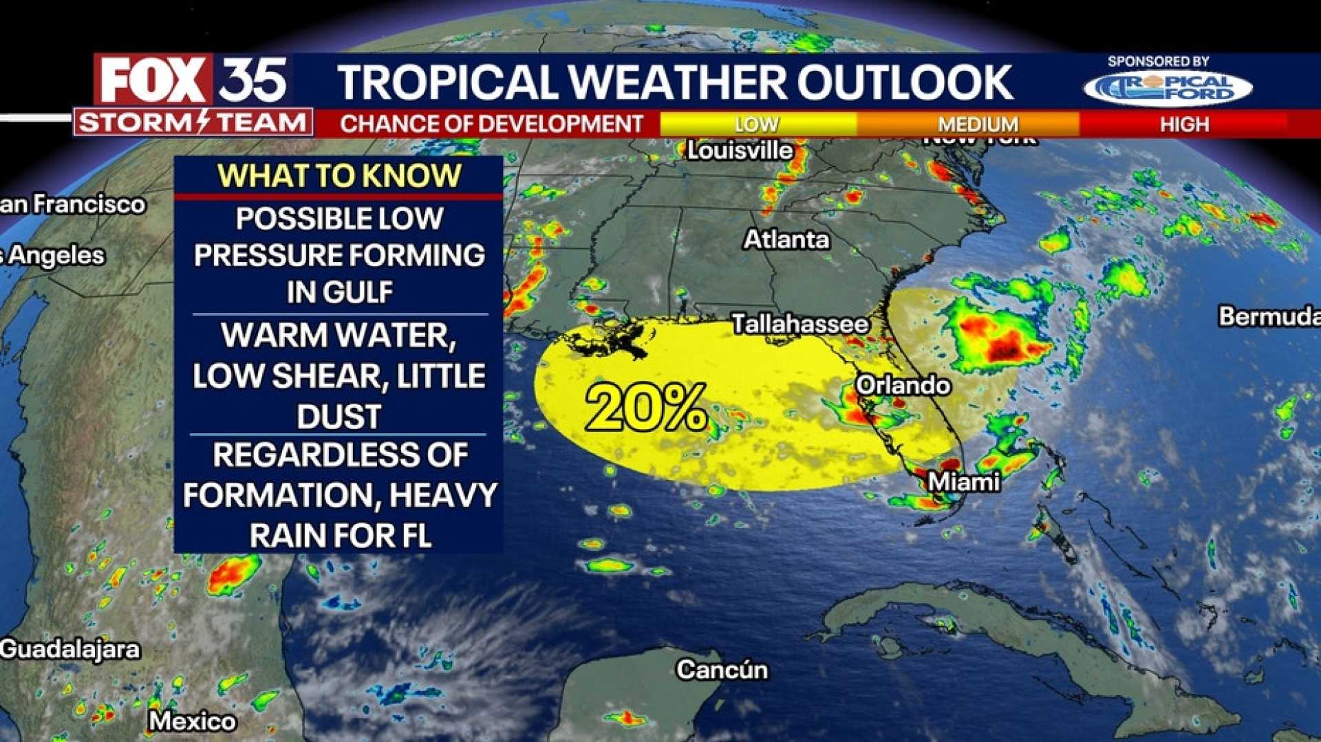
TALLAHASSEE, Florida — The National Hurricane Center is monitoring a cluster of thunderstorms off the coast of Florida for potential tropical development this week. As these storms move westward across the state and enter the Gulf of Mexico, conditions may be favorable for the formation of a tropical depression or storm.
If the system develops, the next named storm will be called Dexter. Weather forecasts indicate that the low pressure system will track across Florida on Monday and enter the Gulf by the evening. Regardless of tropical development, North Florida, including the Panhandle, is expected to see an increase in showers and thunderstorms.
With the low pressure system in place, residents can expect more rain than the typical summer pattern of afternoon thunderstorms. As the week progresses, rain chances are expected to rise in the Panhandle due to increasing instability in the atmosphere.
The National Weather Service has urged residents and visitors to stay informed about the evolving weather situation and to heed any guidance related to possible tropical development.
Although the chances of development currently sit at 20% over the next week, heavy rainfall is likely regardless of whether a tropical system develops. This moisture-rich air could lead to localized flooding, especially in areas already saturated from recent rains.
In Eastern North Carolina, the impact of this potential system remains uncertain. However, any Gulf storm or its remnants could enhance rain chances as it drifts north or east later in the week.
On July 12, the National Hurricane Center identified another possible development area moving from the Atlantic to the Gulf. While conditions are only marginally favorable, there is a possibility of development in the coming days.
Historically, this season has been quieter than usual, hampered by windshear, dry air, and Saharan dust. Despite this, any development this early could signify a more active hurricane season ahead.


