News
Severe Storms Bring Flooding to Philadelphia Region
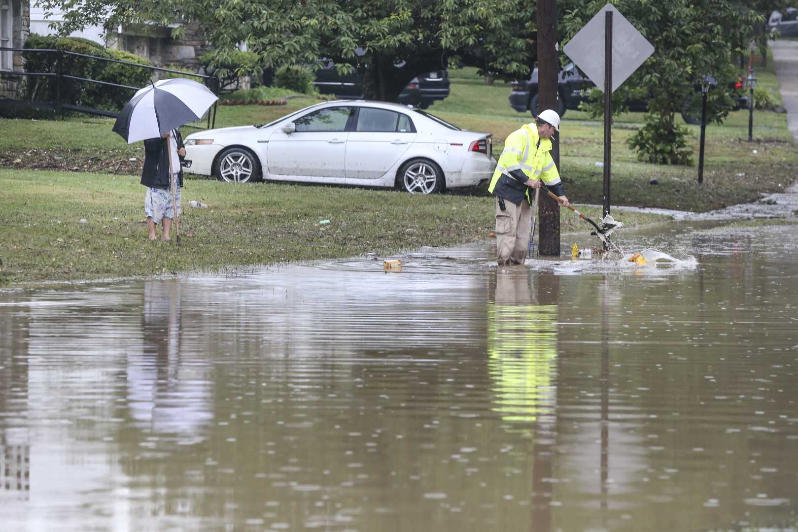
PHILADELPHIA, Pa. — Severe storms swept through the Philadelphia region on Wednesday, August 13, 2025, bringing heavy rain and localized flooding.
The storms interrupted what had been a notable dry spell in the area, leading to flood warnings for Philadelphia and surrounding counties. A flood watch was in effect for the region until 1 a.m. Thursday morning.
Thunderstorms began rolling into the area after 5 p.m., with rainfall measured at up to 3.5 inches in certain areas, including parts of Bucks, Chester, Delaware, Montgomery, and Burlington Counties. The National Weather Service advised that the warnings remained active until 11 p.m. that night.
Frankford Creek in Philadelphia reached flood stage due to the heavy rain. Additionally, Pinewald Road in Burlington Township and the Warren Street underpass at the River Line bridge in Edgewater Park were closed due to flooding.
“Someone probably gets a ton of rain out of this,” warned Dave Dombek, a senior meteorologist with AccuWeather Inc. “Maybe not a ton, but in some places it was several buckets’ worth.”
The flood watch particularly affected the I-95 corridor, which is known for its susceptibility to flooding. Meteorologist Alex Staarmann noted, “that’s just the area most prone to flooding,” as the recent dry weather had left the ground less saturated.
Fortunately, water levels in local streams and rivers were low, thanks to a dry month across the region. No rain was reported in Philadelphia up to that point in August, marking it the coolest start to an August in 12 years and the coolest start on record in Atlantic City, due to air masses that migrated from the Hudson Bay region.
As conditions transformed, another round of storms was expected on Thursday afternoon. Morning fog was anticipated, particularly in the Brandywine Valley of Pennsylvania and Delaware.
Forecasters predict high temperatures in the upper 80s, with additional humidity making it feel warmer. Afternoon storms could lead to flash flooding in some areas along the I-95 corridor.
Looking ahead, Friday is likely to see similar weather patterns, with more scattered thunderstorms possible. However, a dry and sunny weekend is anticipated, giving residents a break from the severe weather.


