News
Severe Weather Alerts Issued for Minnesota as Storms Approach
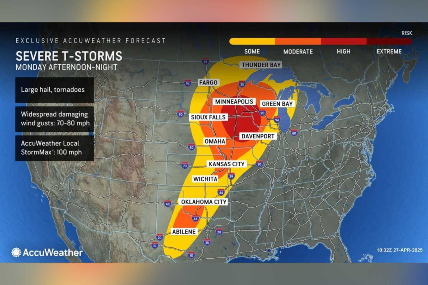
GOLDEN VALLEY, Minn. — Severe weather is set to hit Minnesota on Monday night, prompting KARE 11 to issue a Weather Impact Alert. Residents in southwest Minnesota, stretching from Marshall to Willmar, face a level 4 risk on the severe weather scale, while parts of the Twin Cities metro and areas from Alexandria to Mankato are at a level 3 risk.
KARE 11 meteorologist Wren Clair warns the storm system is expected to arrive between 5 and 7 p.m., bringing damaging winds with gusts up to 75 mph and a possibility of tornadoes. The storms will weaken as they move east, but may still pose a threat when they reach the Twin Cities around 9 to 10 p.m. Residents should also be alert for hail.
Clair emphasized the importance of staying updated, noting that the storm models can change rapidly throughout the day. Currently, the Weather Impact Alert is predicted to expire before sunrise on Tuesday, during which time conditions will initially be sunny and warm.
The following day, Wednesday, Minnesota can expect ongoing heavy rain and strong storms, especially in the southeast, where spillover into Wisconsin is anticipated. John Zeigler from KARE 11 reports that northern Minnesota has already seen heavy downpours, with some areas near Bemidji receiving more than 4 inches of rain recently, resulting in a flood warning.
Storms are gradually moving south, with the best chance for severe weather in the Twin Cities region occurring between noon and 6 p.m. Zeigler indicated that while the primary risks are heavy rain and high winds, there remains a possibility of isolated tornadoes.
As conditions evolve, the focus will shift southward overnight into Thursday, with heavy storms expected to transition into rain.


