News
Storms Forecasted in North Texas, Flooding Risk Persists
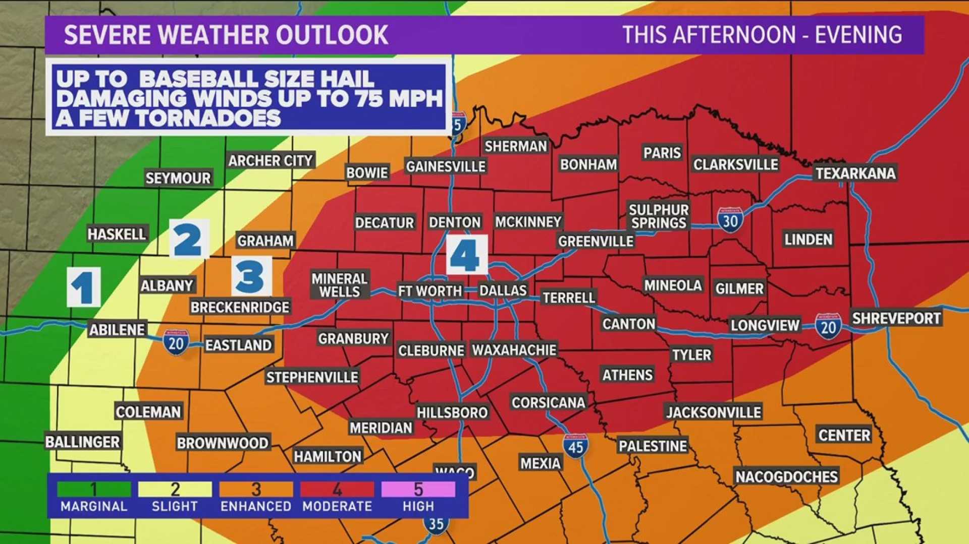
FORT WORTH, Texas — Storm chances remain significant across North Texas today. While a complete washout is not expected, some storms could deliver heavy rain, which may lead to flooding problems.
The National Weather Service has issued a flood watch for much of North Texas, including Dallas and Fort Worth, which is in effect until 7 PM this evening. Rain totals between 1 to 3 inches are anticipated, with some areas possibly experiencing higher amounts.
According to NBC 5‘s meteorologist Adrienne Vonn, scattered showers and thunderstorms will increase throughout the day, becoming more widespread by afternoon. A few storms may even reach severe thresholds.
Looking ahead to Monday, lingering showers and thunderstorms are possible. Weather conditions are expected to dry out after this weekend, and temperatures will rise, hitting the mid-90s by midweek.
Today’s forecast indicates a high of 88 degrees with winds from the south-southwest at 5 to 10 mph. Overnight, the temperature is expected to drop to a low of around 74 degrees with scattered storms continuing.
Monday’s forecast anticipates mostly sunny conditions with a 30% chance of rain, as temperatures reach a high of 90 degrees. As the week progresses, highs are expected to stay mostly in the 90s, with some respite from rain.
Residents are encouraged to stay updated with local news sources for the latest weather developments.


