News
Atlantic Hurricane Season Sees Unprecedented Calm Amid New Disturbances
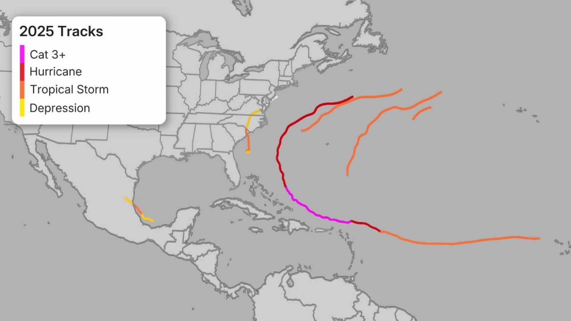
MIAMI, Florida — The Atlantic hurricane season is experiencing an unusual calm as mid-September approaches, with the past 18 days showing no named storm landfalls. According to meteorologist Michael Lowry, this lack of activity is unprecedented, stating, “In the modern satellite era (since 1966), we’ve never seen a shutout during this very active 18-day window of the season, when on average four named storms and two hurricanes form each year.” So far, the Atlantic has recorded the lowest activity since 2014, with only one hurricane — Category 5 Erin — noted.
Interestingly, a similar lull occurred in 2024, which eventually led to two significant hurricanes, Helene and Milton, later in the season. Lowry highlights that while the first half of September 2025 remains quiet, storm models forecast a potential development of a disturbance designated as Invest 92L.
This system is currently situated in the central tropical Atlantic, between Africa and the Lesser Antilles, moving west-northwest at 10 to 15 mph. Satellite imagery shows increased organization, accompanied by thunderstorms with a prominent rotation. Although dry air has slowed development, predictions indicate a 40% chance of becoming a named storm by this weekend, with odds increasing to 80% within the next week.
The next name in line for the Atlantic list of storms is Gabrielle. Historical context is important here; the only named storms so far this year, including Hurricane Erin and lesser storms, have resulted in minimal impacts compared to previous years since 2017. Erin, while a powerful hurricane, also contributed to flooding in the Cabo Verde Islands and coastal erosion in the Dominican Republic.
As for Tropical Storm Mario, it briefly lost its status as a tropical storm on September 13 but remarkably regained strength and was observed again as of September 15, with sustained winds of 60 mph. The storm, currently located off the Pacific coast of Mexico, is also forecasted to contribute moisture to areas in southern California and Arizona.
In contrast, the Northwest Pacific Ocean is also quiet, with no named storms recorded. The current active typhoon season has yielded only 34% of the typical accumulated cyclone energy. According to historical patterns, this could signal approaching significant weather events in the coming weeks.
As of now, forecasters monitor Invest 92L and the development of other potential storms as they begin to form amid the typically active months of hurricane season.


