News
Severe Storms Expected Across Upper Midwest Tonight
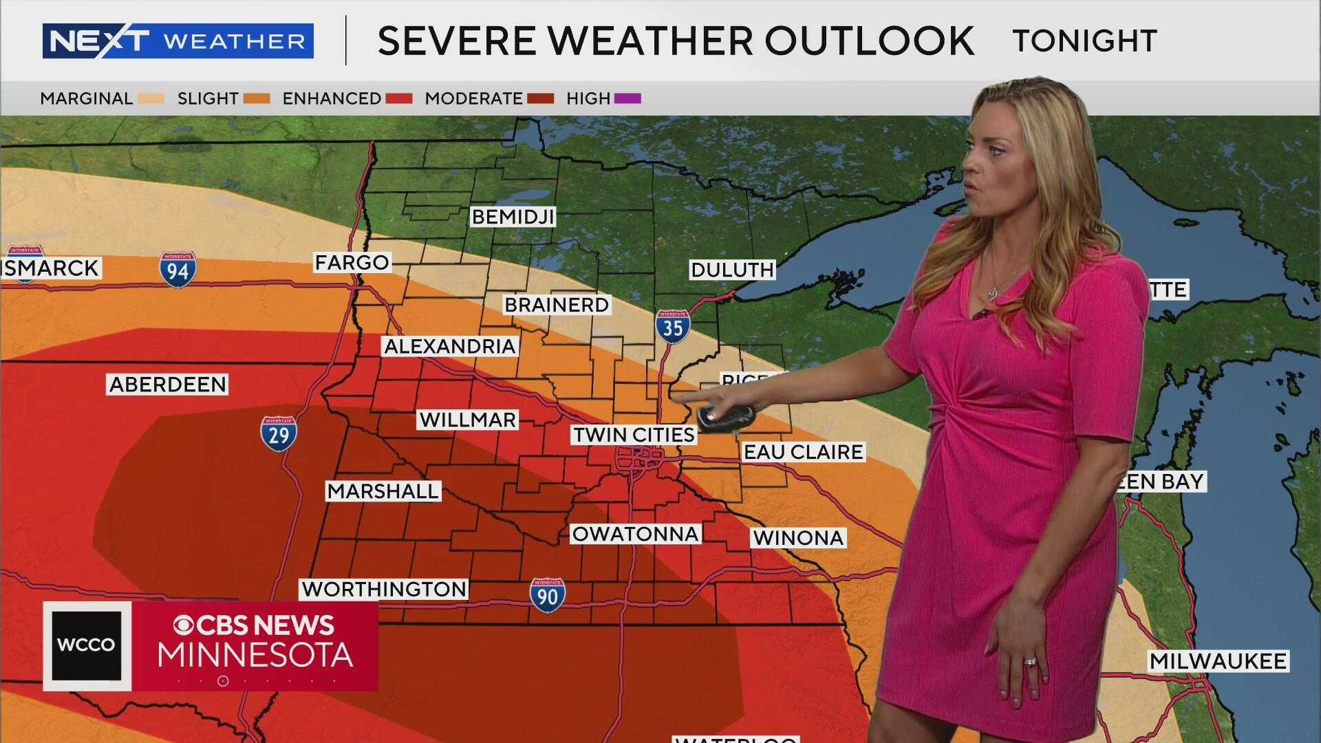
ROCHESTER, Minn. (KTTC) – A Forecast First ALERT is in effect as powerful storms are predicted to move across the Dakotas into western and southern Minnesota tonight. Meteorologists expect these storms to arrive late in the evening and continue into the overnight hours, bringing strong winds, heavy rain, and potential tornado activity.
The storms could produce wind gusts exceeding 75 mph and large hail, with the most dangerous window occurring from 9 p.m. to 3 a.m. Residents in affected areas are advised to prepare and have multiple ways to receive weather warnings.
Meanwhile, Sioux City, Iowa, is experiencing another heat wave, with heat index values rising over 100 degrees. The region has been designated as a First Alert Weather Day, with severe thunderstorms anticipated as storms advance into the area after 8 p.m.
In Siouxland, the Storm Prediction Center has placed northeastern areas under a Moderate Risk for severe storms, posing threats of winds gusting over 80 mph, and possibly as high as 90 mph. A few tornadoes may form, although they are expected to be weaker.
Forecasts also predict heavy rainfall, with up to 2 inches expected tonight. Monday night temperatures will drop to about 70 degrees, with partly cloudy conditions on Tuesday.
In Wausau, Wisconsin, there’s a chance for early morning storms as a cold front approaches. While conditions are not as favorable for severe weather as they are in Minnesota and Iowa, storms are still possible, especially along and west of Highway 13.
Later this week, a high-pressure system settling in from Canada is expected to bring cooler and drier conditions, providing a respite from the heat and humidity. Highs are anticipated to fall to the mid to upper 70s.


