News
Severe Thunderstorm Warning Issued for Boston and Eastern Massachusetts
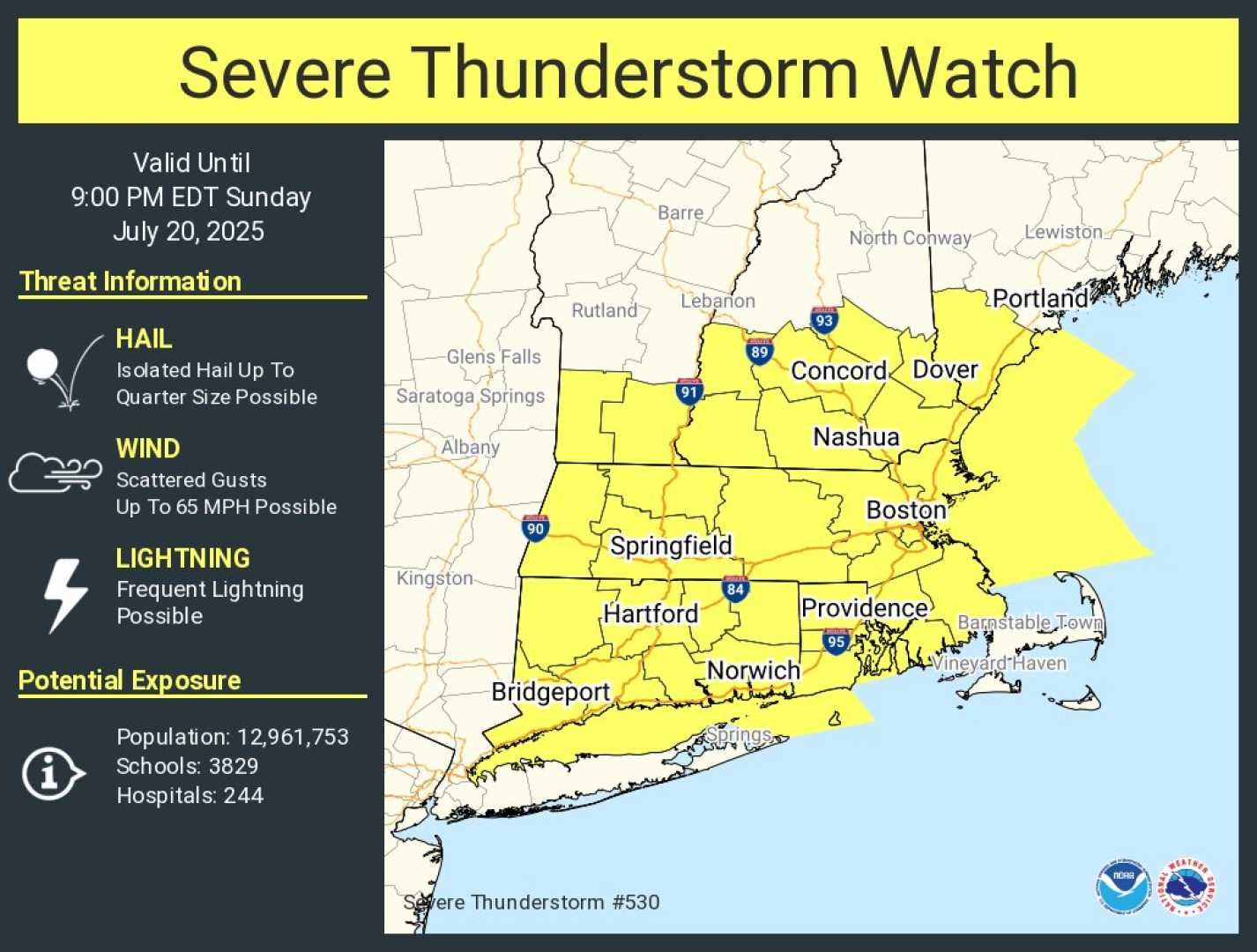
BOSTON, Massachusetts – Much of eastern Massachusetts is currently under a severe thunderstorm warning as strong storms sweep through the area amid hot and humid conditions. The warning, issued by the National Weather Service, is in effect for Bristol and Plymouth counties until 4:30 p.m.
According to StormTeam 5 meteorologist David Williams, a severe thunderstorm impacted Boston earlier this afternoon but has since moved offshore. He reported heavy rain and numerous lightning strikes associated with the storm, which prompted a ground stop at Boston Logan Airport.
While the storm has weakened as it moves away, another severe thunderstorm cell is forming to the south, posing risks of gusty winds up to 60 mph and heavy rain, potentially leading to localized flooding. This storm is on track toward Providence and may also affect areas like Fall River and Taunton.
As the warning continues, the National Weather Service cautions residents about possible hail damage and wind damage to trees and power lines. They recommend moving to an interior room on the lowest floor of a building for safety.
Areas including New Bedford, East Providence, and Dartmouth are among the impacted locations. Additionally, a severe thunderstorm watch is in effect until 9 p.m. for multiple counties, extending to parts of Connecticut and New York.
Officials have also issued a heat advisory lasting until 8 p.m. due to heat index values reaching up to 103 degrees. The NWS advises residents to stay hydrated and avoid staying outside for long periods.
As the severe weather subsides, the forecast for Monday calls for clearer skies and more comfortable temperatures in the upper 70s to low 80s.


