News
Baltimore Weather: Thunderstorms Expected August 13
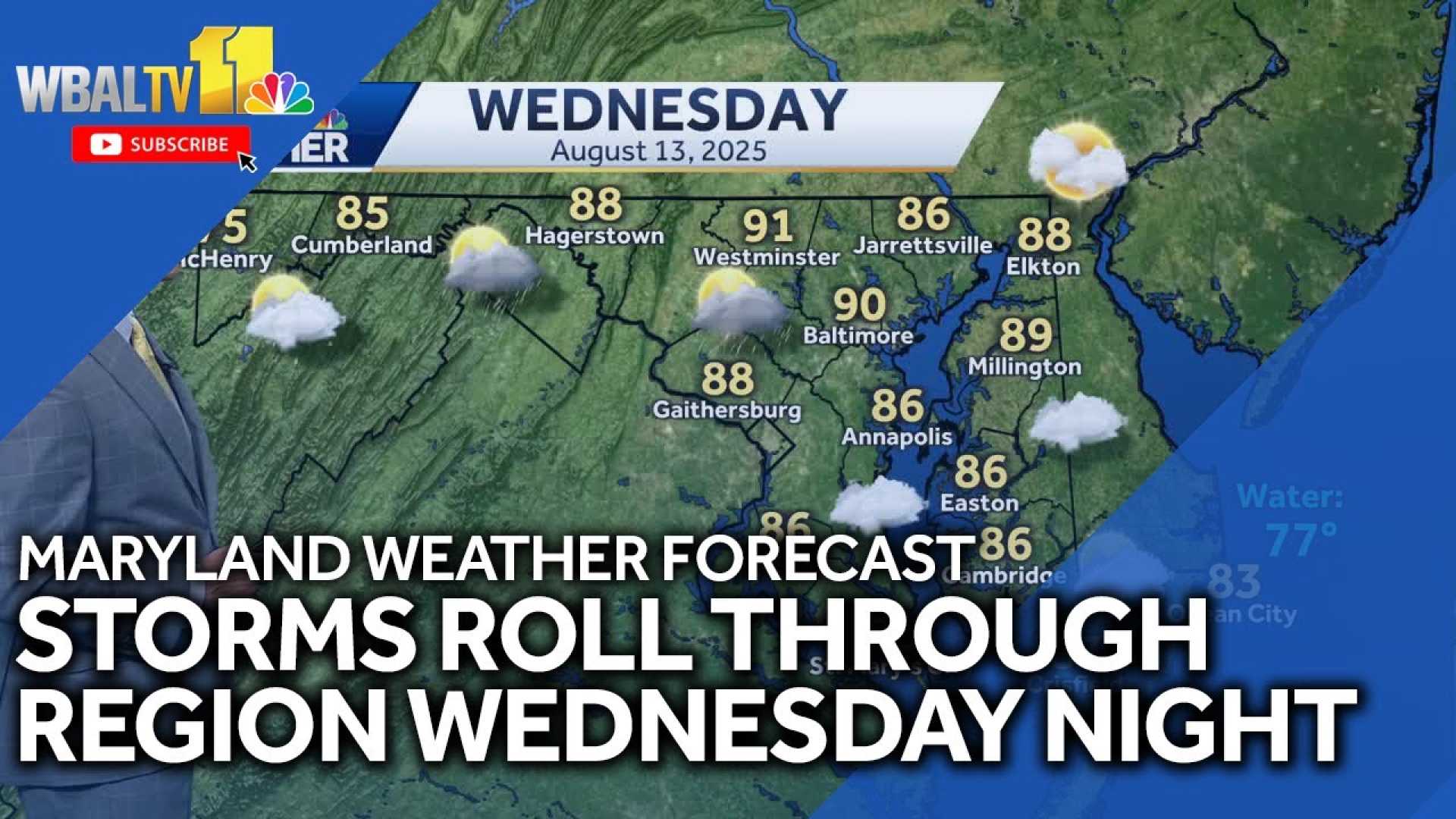
BALTIMORE, Md. — Chief Meteorologist Tom Tasselmyer has declared Wednesday, August 13, as an Impact Day, warning residents of thunderstorms and potential heavy downpours in the Baltimore region.
According to Tasselmyer, a cold front moving in from the west will lead to a high chance of storms in the afternoon, with a 60% likelihood of rain.
This follows a warm summer day, with temperatures rising to around 90 degrees Fahrenheit in Baltimore. Other areas are similarly hot, with Pikesville and Randallstown both reporting 89 degrees, and Pasadena at 88 degrees.
“We are back into typical summertime conditions with humidity returning to what you expect in August,” Tasselmyer said.
The storms, originating from the western Maryland mountains, are expected to develop after 3 p.m. and move toward the Baltimore metro area by 6 p.m. By evening, the storms are anticipated to push southeast toward the Eastern Shore, weakening as they go.
Overnight temperatures are expected to drop to the mid-70s, and the following day, temperatures are predicted to rise again to around 90 degrees.
Officials have expressed concern that some thunderstorms could produce heavy rain and localized flash flooding, particularly in the evening.
Residents are urged to stay vigilant as the storms approach and to report any outages to Baltimore Gas and Electric.
The forecast suggests that despite the cold front, warm and humid conditions will continue into Thursday and Friday. Further on, Tropical Storm Erin is being monitored, which may strengthen into a hurricane by the weekend, though it is currently expected to remain distant from the region.


