News
Tropical System May Bring Flooding to Florida and Gulf Coast
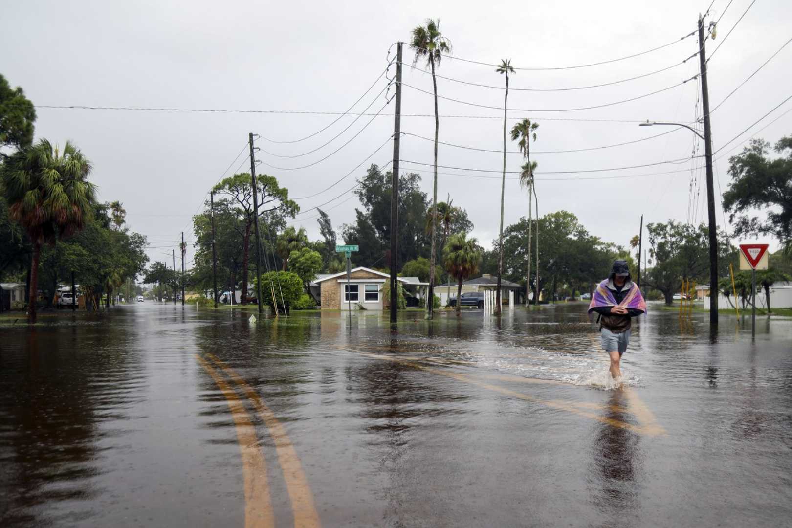
MIAMI, Fla. — Concern is rising this week as a system of storms off the coast of Florida could develop into the next tropical system in the Atlantic. This potential storm presents a flood threat along the Gulf Coast.
Currently, the would-be storm is a sprawling area of showers and thunderstorms situated over the Florida Peninsula. The National Hurricane Center reports it is expected to drift west into the Gulf by midweek, with a medium chance of evolving into a tropical depression.
If it gains a more defined center of circulation, it could be named Dexter, becoming the fourth named storm of the Atlantic hurricane season, typically reached around mid-August.
Warm waters near the coast are excellent for storm development, acting like fuel for these systems in July. However, current unfavorable conditions may hinder the storm’s strengthening, given it may not have sufficient time to mature and will face challenging upper-level winds.
Despite these challenges, some reliable forecast models suggest the system might become more organized and develop into a tropical storm by late this week. Its path will be crucial; if it shifts further south and remains over the Gulf longer, it could strengthen.
Regardless of its potential naming, the system is expected to bring significant rainfall to Florida and parts of the Gulf Coast in the coming days. For instance, Daytona Beach received 2.25 inches of rain on Tuesday, breaking its previous daily record of 2 inches set in 1935.
The National Weather Service has designated a Level 2 of 4 risk for flooding rain across parts of the Florida Peninsula, including Tampa and Orlando, on Wednesday morning. Rainfall rates may increase as the system moves across the state, with expected totals between 1 to 3 inches.
As the week progresses, the most severe flood risks will arise later in the week when the system drifts west into north-central Gulf Coast areas, including Alabama, Mississippi, and southeast Louisiana. Flash flooding remains a major concern, particularly if rain bands linger over the same locations.
On Thursday, southeastern Louisiana, including New Orleans, faces a Level 2 risk for flooding rain, escalating to a Level 3 of 4 for portions of Louisiana by Friday, indicating the potential for several inches of rain in some areas.
While the heavy rain and flooding risks are evident, precise details regarding their extent will depend on the storm’s strength, track, and speed — variables that will be clarified in the coming days.


