News
Severe Storm Warnings Issued for Chicago Area as High Winds and Rain Expected
CHICAGO, Illinois – Severe thunderstorm warnings were issued Monday for several counties in the Chicago area as high winds and heavy rain are forecasted. The warnings, which include Cook, DuPage, Kane, and Kendall counties, are set to remain in effect until 6 p.m.
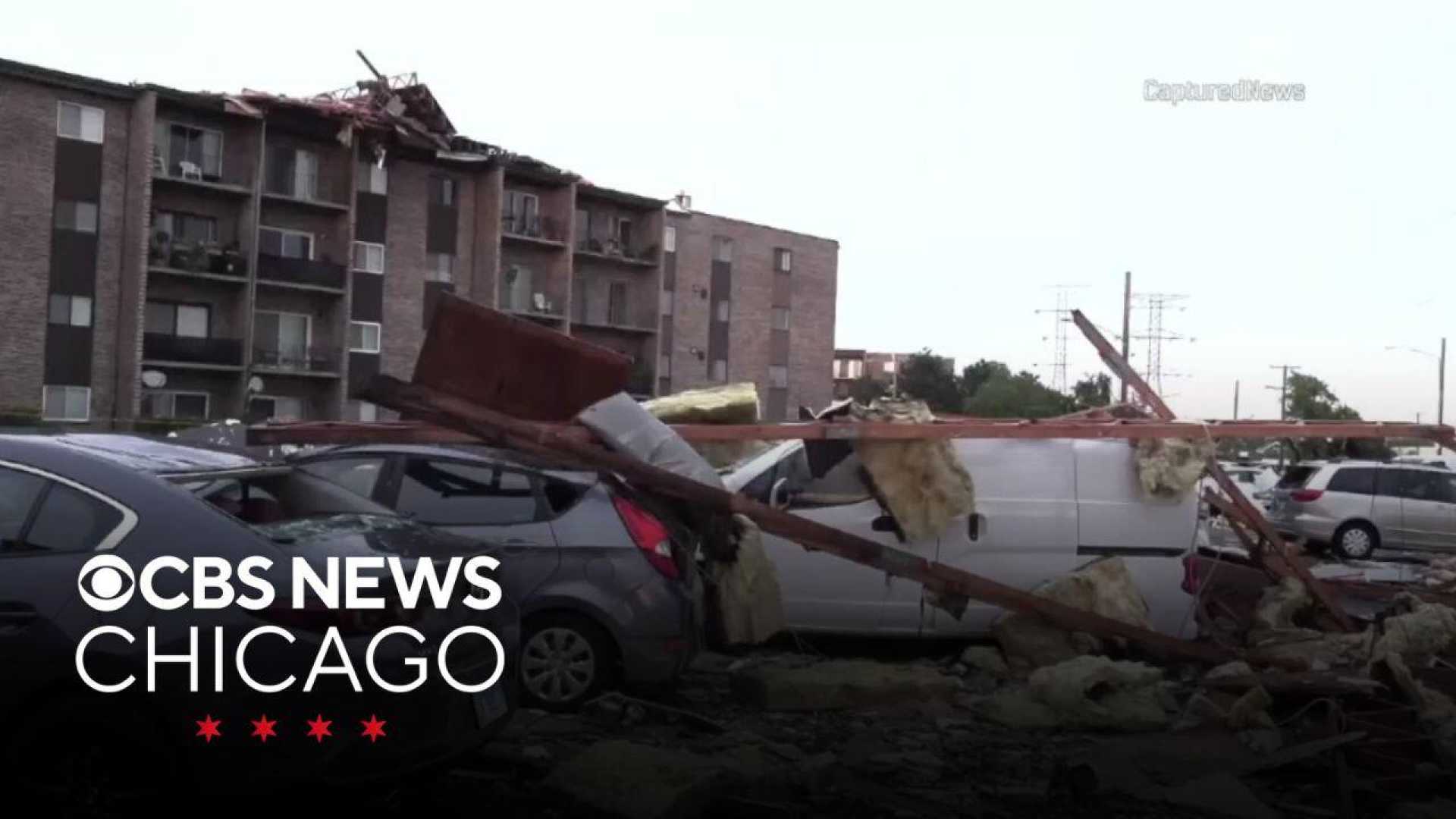
The National Weather Service announced the potential for tornadoes, quarter-sized hail, and wind gusts reaching up to 70 mph. Meteorologists indicated that storms were beginning to move into northwestern Indiana while additional storms were developing in the northwest.
According to ABC7 Meteorologist Greg Dutra, the primary threat this afternoon is high winds and heavy rain, which could lead to flash flooding. Parts of the region, which have already seen substantial rainfall recently, may be particularly vulnerable.
A Flood Watch is currently in place for multiple counties including Cook and Will, continuing until 4 a.m. Tuesday. Earlier rainfall rates reached over two inches per hour, with areas like Mokena reporting 3.4 inches as of 4:20 p.m.
The storm system is predicted to move northeast at 30 mph, prompting ground delays at O'Hare and Midway airports. Following the storms, the area is expected to cool down to the low-to-mid 80s, bringing some relief from summer heat.
The weather is anticipated to dry out by Tuesday with partly sunny skies. This week, temperatures may drop to the upper 70s and low 80s, offering a break from the oppressive humidity noted in recent days.
The significant storm threat emphasizes preparedness as residents are advised to avoid flooded areas and remain alert for ongoing weather updates.


